Grays Arch Trail Guide
Have you hiked on the Grays Arch Trail at Red River Gorge in Eastern Kentucky yet?
Grays Arch Trail is quite an amazing hike and might be our favorite trail so far when we visited Red River Gorge back in the summer. Not only do you get to see an amazing arch, but the whole trail always has something cool to look at. It’s one of those trails that you at least need to see once, twice, or eight times.
In this guide, I’ll share my experience and tell you everything you need to know about visiting and hiking the Grays Arch Trail at Red River Gorge in Eastern Kentucky.

Information and History About Grays Arch Trail
Grays Arch Trail, much like any other area in Red River Gorge, has a great history to it.
The geological history of this arch is always very fascinating because of the ancient oceans, glacier periods, and earthworks that went in to create these natural windows into the rocks. Of course, these areas were used by very early Native Americans for their spiritual symbols. Later, as Europeans settled into the area, the arch remained as the land was cleared for living.
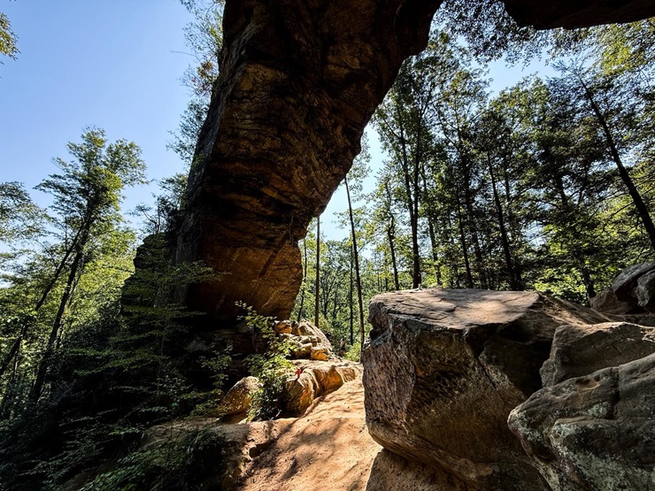
Today, Grays Arch Trail is one of the most frequently visited trails at the Red River Gorge. Much like Garden of the Gods in Southern Illinois, Grays Arch is a trail that everyone should visit at least once. The massive arch is around 50 feet in height and around 80 feet in length, which makes it a very large natural arch to see with your own eyes.
For more information about this area and the Red River Gorge, see the US Forest Service’s official website for the area.
How to Reach Grays Arch Trail
Use this Google Maps Link to get to Grays Arch Trail from Slade, Kentucky.
There is a mix of paved and gravel roads to Grays Arch. The gravel roads are frequently used, meaning erosion and potholes are present. Please exercise caution and drive slowly when using these roads to reach the trailhead.
There are many parking spots available at the Grays Arch Trailhead and other trailheads around that provide more space. However, this is a very popular area, and the spaces will fill up fast. The Forest Service is strict about not allowing parking in undesignated areas, so be sure to arrive as early as possible to get a space.
During heavy rainfall and wintry conditions, this area may be very difficult to access. Please check the weather and road conditions before visiting.
What Your Will See at Grays Arch Trail
After parking, you’ll get on the Grays Arch Trail, which is signed.
First, it’s a nice walk in the woods with some hilly conditions. Then, you’ll start to reach some of that good old fashion Kentucky bluffage and natural shelters. We could tell that if it were a wet day, there would definitely be some waterfalls along the trail, but we went in August when it was bone dry.
After you go down a long set of wooden stairs, you’ll start to get into the real bluff of the area. There is a massive bluff shelter right before you get to the arch that is really amazing to see and very photogenic. They have some fencing in front of it, which tells me they don’t want people to go beyond the fencing, so I suggest staying on the designated trail out there.
Right after the big shelter, you’ll come up to the actual Grays Arch, which is very amazing looking. You can go all around it and take plenty of photos and videos. I tried to look for an easy way to the top of it, but I couldn’t find it and didn’t want to test my chances of accidentally hiking into a copperhead.
The hike was 3.3 miles in length, out and back, with 476 feet of elevation gain. It took us about 2 hours to hike. We hiked in the summer, but I think the best time to visit would be during fall colors or during leaf off, so you can see everything and likely run into fewer people. (AllTrails Map)
Special Guidelines and Safety Information
Be sure to abide by the following guidelines when visiting the Grays Arch Trail:
- Stay on the designated trail to help preserve the environment and for safety.
- Pack out what you pack in. The picnic area does have trash cans.
- You can camp as long as it’s 100 yards from the trail.
- Do not harass any wildlife in the area, and that includes snakes.
- You may only park in designated parking spaces. Parking outside of those will likely result in a citation.
Safety is very important when visiting this trail. Be extra careful about creeks, edges of cliffs, and the stairs. Watch your children and loved ones at all times and ensure they’re being safe about hiking.

Lodging, Dining, Shopping, and Sightseeing Nearby
There are plenty of great places to lodge, dine, shop, and sightsee nearby to this trail.
Check out the Where to Stay section on the Red River Gorge website to find nearby cabins, yurts, treehouses, campgrounds, and hotels. Airbnb also has many areas to rent for the night around this area. We stayed at Koomer Ridge Campground and really enjoyed our accommodation there.
The nearby town of Slade has a lot of great places to eat and many places to shop. While visiting Slade, we recommend checking out the Kentucky Reptile Zoo to see some really cool animals. There is a lot to see and do around the Slade, Kentucky area.
For other trails in the area, we recommend checking out the Hidden Arch and Silvermine Arch Trails at Koomer Ridge Campground. We also enjoyed hiking at Natural Bridge Resort State Park in Slade. Red River Gorge has miles upon miles of beautiful and scenic hiking trails to enjoy.
Final Advice About the Grays Arch Trail
The Grays Arch Trail turned out to be one of our favorite places to hike when we visited Red River Gorge. Just make sure you arrive as early as possible for the best parking space. The hike is easy, but I recommend slowing down so you can take it all in.
I hope you enjoyed this free guide today. If you’d like to support me in creating these guides, I welcome you to become a Patreon Member for as little as a few dollars a month. Your contribution goes a long way, and you can easily cancel at any time if it’s not for you.
I also do a free monthly newsletter where I share hiking tips, gear reviews, and upcoming local events in and around the Shawnee National Forest. I recommend you subscribe today.
Do you like talking about hiking and backpacking with others? I run a free discussion forum all about hiking anywhere in the world. Join today and enjoy a community rather than an unmoderated social network.
And until next time, I’ll see you on the trail!
Watch the videos for this trail!
Below is a recent video that we filmed while enjoying this area.
Check out the trail gallery!
Enjoy these photos taken around this area!

Grays Arch Natural Shelter
Grays Arch Trail Sign
Grays Arch Trail
Grays Arch
Please Support Hiking with Shawn
Alrighty folks, I hope you have enjoyed this content. I provide it for free and it takes a while to create. If you would be so kind enough to support my efforts, you can do so by sharing this post with others, especially on social media. Be sure to subscribe to my YouTube Channel to see my latest videos, shorts and live streams. Follow me on Facebook, Instagram, and Twitter for unique content that you will only find on those pages. You might also join my Southern Illinois Hiking & Outdoor Resources Group on Facebook, too!
You can also support me by becoming a Patreon Supporter for as little as $3/month and you can cancel anytime (no contracts or catches). Patreons get access to extra features, exclusive articles, sticker packs, gifts and more. Consider buying official Hiking with Shawn Merchandise as another way to support me. I spend a lot of money on Hiking with Shawn and because of extremely high public land permit fees, I make very little money in return so everything helps.
Thanks again for checking out another one of my articles and until next time, I’ll see you on the trail!

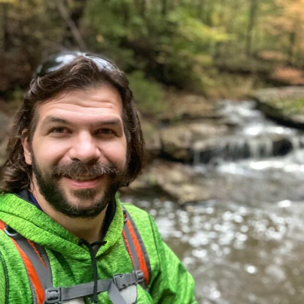
Shawn Gossman
Founder, Hiking with Shawn
Howdy folks! My name is Shawn Gossman and I founded Hiking with Shawn. I’m an avid hiker, cyclist and outdoorsman here in the Shawnee National Forest. I was born and raised in Southern Illinois and never want to leave. Click here to learn more about Shawn Gossman