Auxier Ridge to Courthouse Rock Trail Guide
Have you ever hiked the Auxier Ridge to Courthouse Rock Trail at Red River Gorge in the Daniel Boone National Forest in Eastern Kentucky?
In this guide, I’ll show you everything you need to know about hiking this trail, from what you need to take with you to navigating the trail, so you don’t get lost, and everything in between.
If you find this guide to be helpful, consider leaving me a small one-time tip for taking the time to create and publish it.
Trail Snapshot
Important trail information that you should know:
- Location: Red River Gorge, Daniel Boone National Forest, Kentucky
- Trail Length: 4.2 miles
- Elevation Gain: 730 feet
- Type: Out-and-Back
- Average Time: 2.5 hours
- Difficulty: Moderate
- Pets Allowed: Yes (Leashed)
- Restrooms: None
- Parking: Plenty, but it fills up fast on nice days
- Road Conditions: Mix of paved and gravel with potholes (use caution)
- Best Seasons: Fall, Winter
PRO TIP: There are many parts of this hike that are in the sun. Be sure to bring plenty of sun protection with you if visiting on a clear and sunny day.

Why the Auxier Ridge to Courthouse Rock Trail is Worth Hiking
The Auxier Ridge to Courthouse Rock Trail is a really fun and unique hiking trail.
There is something to see around every corner. You’ll enjoy scenic viewpoints, bluffs, rock formations, a diverse forest, and wildlife sightings. If you’re into birding, this would also be a really good trail for you to hike to see various types of birds.
This trail is very unique compared to the rest of the hiking trails around Red River Gorge in the Daniel Boone National Forest.
Trail Map + Directions
To hike the Auxier Ridge to Courthouse Rock out-and-back trail, I suggest using one of the following apps on your phone:
- AllTrails Page for this trail
- Avenza Page for this trail
To drive to the trailhead for this hike, use this Google Maps Link or follow the directions below:
- Drive towards KY 15 South
- Turn east on KY 15 South and drive for 3.3 miles.
- Turn Left onto Tunnel Ridge Road and drive for 3.6 miles.
- Turn right to stay on Tunnel Ridge Road and drive for 0.1 miles.
- You’ll then arrive at the Auxier Ridge Trailhead.
There is a mix of highway, asphalt, and gravel roads along the way to the trailhead. The gravel roads can be narrow with some erosion and potholes. Any vehicle should be fine to take there but use caution on the gravel and watch for areas of the road that will require you to slow down as you go over them.
Use even more caution and check conditions before traveling during wintry precipitation and flash flood conditions, as access may be impassable.
While visiting this area, my Verizon-powered phone service was spotty and mainly out of service. I’m unsure if other carriers are the same. I would just assume your cell phone will have no coverage when visiting this area.
What You’ll See on the Auxier Ridge to Courthouse Rock Trail
Now, I’ll break down what you’ll see once you arrive and start hiking the Auxier Ridge to Courthouse Rock trail.
The parking lot is fairly large and fits many vehicles. However, this place gets popular on nice days, so you’ll need to arrive early for a better chance of securing a spot. Parking in an unauthorized area will likely get you a ticket, as they are very clear about not doing that there.
The first part of the trail is a switchback taking you up to the ridge, and it can be a gut-busting hill for many hikers.
Once you get about halfway there, you’ll start to see more pretty scenes. There are some amazing scenic overlooks that are very high up along this trail. There are also a lot of cool bluffs, some natural shelters, and rock formations along the way.
You’ll eventually get to the big scenic overlooks where you can see miles upon miles of gorge and National Forest, and then make your way down to Courthouse Rock.
This whole trail offers you a lot to see. There was never really any point on the trail where we were bored. The end result was definitely worth the hike and hills to see the beauty that it offers visitors.
How Difficult is Auxier Ridge to Courthouse Rock Trail
The Auxier Ridge to Courthouse Rock Trail is moderately rugged.
The majority of the trail contains a steep rolling hill environment. Some of the hills are very gut-busting, to say the least, and should not be done by those who are unprepared or very beginner. You’ll definitely need to yield for other hikers in many spots along the way.
There aren’t any major rock scrambles, but some areas require you to strategically get around the rocks, and you might need to sit on your bottom and scoot off them at some point.
The trail is mainly made up of dirt. However, there are some rocky areas, especially around the overlooks and on your way to Courthouse Rock. The rock could become slick when wet or even when dry because of loose dirt and dust on the surface.
Many parts of the trail are exposed to the elements, meaning it could create a need for sun protection as well as rain gear during certain seasons and on certain days.
There were no major creek crossings present. I would only consider the most dangerous parts of the trail to be the edges of the overlook, which you can avoid entirely. The hilly terrain was honestly the hardest part of the hike.
Best Time to Hike Auxier Ridge to Courthouse Rock Trail
If you want to avoid bugs, humid weather, and the crowds, winter is likely going to be the best season to visit, but other seasons also offer other benefits.
In the springtime, you’ll see beautiful wildflowers, and everything starts to wake up and come alive. In the summer, there is more shade, and everything is green. In the fall, you’ll see amazing autumn colors. Winter means leaves are off the trees, and you can see everything.
Just be sure to use caution when visiting during the colder months, as wintry precipitation will definitely increase the risk of using this trail.

What to Bring on This Trail
Make sure you wear and bring the right stuff with you when visiting the Auxier Ridge to Courthouse Rock trail.
For gear, bring a hiking-specific backpack full of at least the 10 essentials to be on the safe side. I’d definitely make sure you brought plenty of water (no real water sources on the trail), some snacks, sun protection, and raingear to this trail in specific.
Make sure you wear comfortable hiking boots or shoes with good traction to hike on dirt and rocky terrain. Wear comfortable, season-specific hiking or athletic clothing that wicks moisture and helps to keep you dry. Don’t forget sunglasses on sunny days for the areas where you’re exposed to a lot of sunlight.
Safety Notes and Warnings
Safety is more important than ever when visiting the Auxier Ridge to Courthouse Rock trail.
- The main hazard at this location is cliff/bluff edges. They’re really high up, and falling from them will most likely result in death. The edges will be slick when wet and could even be slick from dust on the rock surface when dry.
- In some areas on the trail, during very heavy rainfall, there could be flooding issues on the lower end.
- For the most part, the trail is easy to follow, but some people report poor signage in the area. We used the AllTrails App (offline) to keep us on the trail. My link is an affiliate link, and while it doesn’t impact your price, I may earn a commission from it.
- Each season brings its own hazards. Snakes in the summer. Slippery conditions in the winter. Be mindful of seasonal hazards when hiking this trail.
- While we didn’t see any snakes on this trail, locals report that the area sees a lot of copperhead (venomous) snakes. Be sure to watch your step at all times to avoid any negative encounters with snakes and other wildlife.
- During warmer seasons, you can expect ticks, mosquitoes, and other biting pest bugs. Bring plenty of repellent and apply it frequently to avoid getting bitten. Check yourself for ticks after every hike.
- Many areas of the trail will be exposed to the elements and away from the forested canopy. Bring sun and rain protection just in case.
- Be mindful of hunters in the area during hunting season at Daniel Boone National Forest. Wear blaze orange to keep yourself safe. I recommend alternative hikes during hunting season to be even safer.
The important safety tip I can give you for visiting this area is to use common sense and put safety before anything else.
If you get hurt or lost, typically the Wolfe County Search and Rescue team will be activated. These volunteers are some of the best SAR officers I’ve ever encountered. However, avoiding incidents will help ensure you and these volunteers are not put in unsafe conditions.
Your safety can impact other people and their safety, so please think before you act.
Photography Tips
There are many great photogenic viewpoints along the Auxier Ridge to Courthouse Rock trail.
There are a few scenic overlooks as you make your way to the very top of the ridge that are worth stopping to take photos at. However, the top of the ridge is going to be the best vantage point. You can also get many great shots from the ridge top and forward as you make your way to Courthouse Rock.
The best time of day and conditions will be during golden hour or when the weather is partly cloudy for better wide-angle shots.
Different seasons will give you different photogenic scenes, such as wildflowers in the spring and autumn colors in the fall. Summer gives you more shade to fight with on sunny days, but the area is so green and pretty looking. Winter usually means you can see everything since all the leaves are off most of the trees.
There are a lot of prohibited areas and restrictions on drone use, but I would recommend calling the Ranger District for that area before using them to make sure it’s legal.
Nearby Trails to Hike
While visiting this area, I also recommend you check out other great trails we hiked.
We enjoy hiking the Natural Bridge Trail at Natural Bridge State Resort Park. While staying at Koomer Ridge Campground, we hiked the Hidden Arch and Silvermine Arch trail. Before hiking the Auxier Ridge to Courthouse Rock Trail, we enjoyed Grays Arch, which was one of our favorite hikes during our whole visit.
AllTrails lists even more hikes in Red River Gorge worth checking out. (Affiliate Link)
Who is Auxier Ridge to Courthouse Rock Trail Best For?
This trail is best for hikers who are experienced in hiking the more moderate and rugged trail system.
I would not recommend this trail to beginners, users with limited mobility, or families with young children. There are many dangerous cliff edges that people and pets could fall from if they get too close. If you like fitness with scenic, photogenic views, this trail is definitely for you.
What To Do Near Auxier Ridge to Courthouse Rock Trail
Be sure to shop local when visiting this trail for your dining, lodging, and shopping needs.
Slade is the closest town to the Auxier Ridge to Courthouse Rock trail. I recommend checking it out for your dining, lodging, and shopping needs. Check out the Red River Gorge website for places to go for various things.
Final Verdict for Auxier Ridge to Courthouse Rock Trail
We hiked this trail when it was really hot, and I was overheating pretty quickly. I would go back when it was cooler, so that I could enjoy more of the hike. I’d definitely hike this trail again and again now that I’ve experienced it.
Thank you for reading this guide. If you found it useful, consider supporting me for writing it. You can support me monthly for a few dollars a month or give me a one-time donation.
Be sure to check out my monthly newsletter and my discussion forum. Both are free to join and packed with all sorts of exclusive hiking tips and information. They’re a great way to escape the social media rat race.
And until next time, I’ll see you on the trail!
Watch the videos for this trail!
Below is a recent video that we filmed while enjoying this area.
Check out the trail gallery!
Enjoy these photos taken around this area!
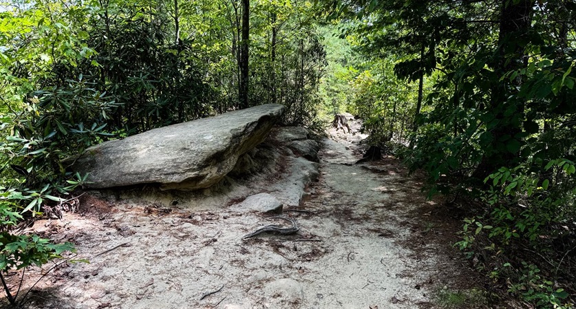
Auxier Ridge to Courthouse Rock Trail Condition
Auxier Ridge to Courthouse Rock Trail
Red River Gorge Scenic View
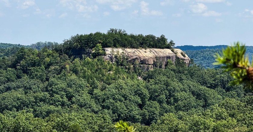
Top of Courthouse Rock

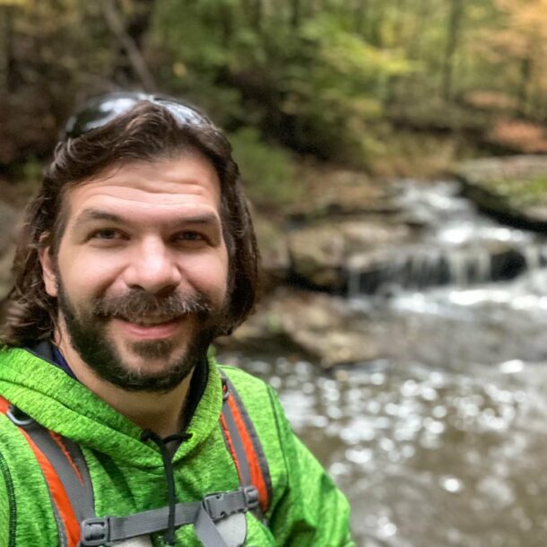
Shawn Gossman
Founder, Hiking with Shawn
Howdy folks! My name is Shawn Gossman and I founded Hiking with Shawn. I’m an avid hiker, cyclist and outdoorsman here in the Shawnee National Forest. I was born and raised in Southern Illinois and never want to leave. Click here to learn more about Shawn Gossman