Hiking with Shawn’s
Trail Guide Series:
Ferne Clyffe State Park
Ferne Clyffe State Park is a very beautiful and scenic Illinois state park located in the center of the southern Illinois region. Ferne Clyffe State Park offers a little something just about every type of public land recreation user group. There are plenty of waterfalls, scenic overlooks, nature preserves, hiking trails, equestrian trails, camping, picnicking spots and even a fishing hole. Ferne Clyffe State Park is a great place to visit if in the Marion and Carbondale area. The River to River Trail also runs through Ferne Clyffe State Park as well.
The closest town to Ferne Clyffe State Park is Goreville. Goreville is about 5 minutes away. There are a few gas stations, a Subway, a bank, a dollar store and a really good pizza place called Whiffle Boys. Other trails and recreation areas near Ferne Clyffe State Park include Dutchman Lake, Bulge Hole, Odum Tract and Tunnel Hill State Trail. Camping is available at Ferne Clyffe State Park, both electrical and non-electrical sites as well as backpacker and equestrian camping.
Directions and Stuff!
Check out this map for directions to get to Ferne Clyffe State Park. You can also see the various hiking trails and user-contributed points of interest within the area, on that map.
All roads to get to Ferne Clyffe State Park and its main trails are paved and easy for all vehicles. Please note that the park is known to close its gates during heavy snow and ice. Within the main state park, there is ample parking available. This area gets a very large number of visitors during warmer months, especially on the weekends.
If you visit the remote portion of the park, Bork Falls (Hippie Hollow), do note that this particular road is gravel and very rough in some spots. Please drive slowly and respect others that live along that road. The creek that feeds Bork Falls flows across the road.
What You’ll See!
As I mentioned above, there are a number of options on how you can enjoy Ferne Clyffe State Park. However, since my website focuses mainly on hiking, that will be the topics down below. But do note that there are all sorts of different user-based activities throughout the park including rock climbing, too! Now let’s dig into the hiking trails:
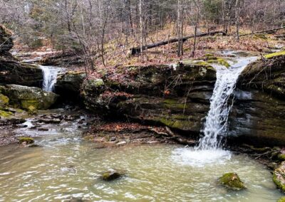
Rebman Trail – This .25-mile loop trail is one of the official areas where you can legally rock climb in the park. During wet days, there are 2-3 waterfalls along this trail that are very worth seeing. There is plenty of bluffage, a very scenic creek, cave shelters and even carving from long before the land was turned into a state park. The trail was named after Emma Rebman, a very famous woman who once lived on the land that is now the park. A plaque has been dedicated to Emma Rebman along the trail.
This trail is mostly easy but there are points where you have to cross a creek by the waterfalls that will be rocky. If wet, expect to get wet and dress appropriately. Hiking Only!
NOTE: To access this trail, you have to cross a creek. The creek has concrete, permanent stepping-stones to do so. However, during very wet conditions, the stepping-stone will be underwater. The creek is usually no more than a couple feet deep and it is concrete where the crossing is.
Goreville Boy Scout Trail – This .5-mile out and back trail connects the state park with the Village of Goreville. The trail overlooks forests on both sides and features a creek to one side that is very scenic. The creek will cross the trail when it is really wet, and it creates a waterfall as it leaves the trail on the other side. That waterfall feeds one of the bigger waterfalls on the Rebman Trail. This trail used to be the road to access the park from Goreville and the only way into the park. The Illinois Department of Conservation closed the road for ecological and safety reasons and created the new road into the park. The people of Goreville protested the closure and it caused quite a stir, worth researching.
This is a moderately difficult trail because it is uphill and steep all the way until it reaches the end at Goreville. You also have to walk across water over the trail (concrete pad) and could get wet. Hiking Only!
NOTE: To access this trail, you have to cross a creek. The creek has concrete, permanent stepping-stones to do so. However, during very wet conditions, the stepping-stone will be underwater. The creek is usually no more than a couple feet deep and it is concrete where the crossing is.
Hawk’s Cave Trail – The .5-mile loop trail takes hikers through a well-managed hardwood forest to one of the largest natural shelter caves in the area. This large shelter cave features two fairly large waterfalls when the area is very saturated from rainfall. It is said that when this area was private property long before the creation of the state park, those who explored it noticed all the ferns which gave the park part of its name, Ferne Clyffe. The shelter cave is the main feature of this trail.
This is a fairly easy trail with no major hills or creek crossings aside from the main creek where you park your vehicle at. Hiking Only!
NOTE: To access this trail, you have to cross a creek. The creek has concrete, permanent stepping-stones to do so. However, during very wet conditions, the stepping-stone will be underwater. The creek is usually no more than a couple feet deep and it is concrete where the crossing is.
Big Rocky Hollow Trail – This .75-mile out and back trail will take hikers to the most popular point of interest in the entire state park, the main waterfall. The main waterfall is 100-feet tall with a second level large natural cave shelter within it. The trail also features additional smaller waterfalls, scenic creeks, bluffage and a beautiful hardwood forest. In the early years people would slide down the waterfall from the top and quickly grab a bar (that is no longer there) towards the end to ensure they didn’t fly off the cliff. The top of this waterfall has a user-made trail to it – the park does not wish for people to use it. There have been falls leading to fatalities from the top of this waterfall. Please use caution and respect the guidelines of the state park.
This trail is moderately difficult due to a few different areas where the creek will cross the trail when it is very wet. There is a chance you will get wet so please appropriately. This trail could have been fairly ADA compliant if the bridge present allowed for wheelchairs to cross them with ease. Maybe that will happen in the future, hopefully. If the park is open, this is a wonderful spot to see a nice frozen waterfall! Hiking Only!
Blackjack Oak Trail – This 1-mile out and back trail starts at the Ferne Clyffe Lake and ends near the Big Rocky Hollow Trail. This trail features very scenic overlooks which are great for viewing the lake with fall colors. This trail also features bluffage, awesome natural cave shelters and can be used for a longer way to Rebman, Hawk’s Cave and Big Rocky Hollow trails. The sign for the start of this trail is fairly hidden away in the forest and many people don’t even realize it is there. This trail also features some waterfalls when the area is very wet.
This is a fairly rugged trail as there are rolling hills, difficult terrains and creeks present. This trail is for Hikers Only! This is probably one of my favorite easier but still rugged trails within the state park.
Ferne Clyffe Lake Trail – This 1-mile loop trail offers hikers a chance to follow the banks of the Ferne Clyffe Lake. The lake is very small and allows for bank fishing. Boats of any type or swimming is not allowed within the lake. The lake is an excellent and popular location for photography especially around the time during fall colors. Aside from the lake and the hardwood and pine forests around it, there isn’t much else to see.
This trail is fairly easy but can become difficult when wet due to creek crossings along the backside of the trail. This trail is for Hikers and fisherman only.
Round Bluff Nature Preserve Trail – This 1-mile loop trail offers hikers a chance to enjoy a nice scenic hike through the park’s dedicated and protected nature preserve. Do note that since the area is an official nature preserve, you may only hike on designed trails to help protect the precious ecosystem within the area. There are user-made trails leading to the top of the bluff, but they are not official and park officials ask that you do not use them. This hiking experience features bluffage, scenic forests, a nature preserve, shelter caves and wildflowers during different times of the year.
This trail can be difficult due to the steep hilly conditions. There are also stairs for easier access in the hillier portions of the area. This trail is for hikers only.
Happy Hollow Trail – This 5-mile loop trail is probably my favorite trail within the park’s entire trail inventory. There is a lot to see along this trail and some of it includes portions of the River to River Trail. Along this trail, you can see bluffage, waterfalls, very scenic creeks, old signs from the past, wildlife plots, various types of forests and even a natural arch. You can also access the backpackers and horse campground from this particular trail.
This is a difficult trail as you will cross creeks several times, encounter difficult and rugged terrain, hike rolling hills and experience a more wilderness-backcountry like experience while hiking along this area. This trail is only to hikers and in some areas, equestrian users. Equestrians may not use the trail November 1 to April 30 each year. Please yield to equestrians at all times and speak calmly to the rider so that the pack animal realized you are a human and not a threat. Protect yourself, the rider and the animal by yielding and putting safety first. Camping is only allowed along this trail within dedicated campground areas.
Cedar Bluff Trail – This 3-mile out and back trail is located in a remote portion of the park away from the main state park property. This is another area where you can legally rock climb at. Along this trail, you will see bluffage, scenic creeks, forests and a very scenic overlook on top of the main bluff. Parking is by a church – please ensure that you give plenty of room for others to park during services.
This trail is considered rugged with rolling hills and difficult terrain. This is a hiking only trail.
Big Buck Creek Trail – This 2-mile out and back trail is located in a remote portion of the park away from the main state park property. This hike is very scenic giving you views of the Big Buck Creek, hillsides, old signs from the past and plenty of bluffage as well.
This is a moderately difficult hiking trail with rolling hills and creek crossings.
Bobcat Loop Trail – This 1-mile loop trail is located in the remote area near Cedar Bluff. There are many scenic views along this trail including creek and bluffage.
This is a moderately difficult hiking trail with rolling hills and creek crossings.
High Ridge Trail – This 1.5-mile out and back trail splits off Big Buck Creek Trail and follows a high ridge line. There are a lot of scenic views along this trail.
This is a moderately difficult hiking trail with rolling hills and creek crossings. This trail is open to hikers and equestrian users. Hikers should always yield to horseback riders and speak to them calmly, so the horse knows that you are not a threat.
Bork’s Waterfall Trail (Hippie Hollow) – This .5-mile out and back trail provides access to the famous Bork Falls waterfall. This is a very large waterfall and natural cave shelter that is fairly easy to get to. This waterfall is really dependent on rainfall.
This is a moderately difficult hiking trail and available to hikers only. The road to this trail at times is very rough due to erosion from rainfall and vehicle use. People live along this road – please drive carefully and respect those who live in the area. Parking is allowed in designated parking areas only!
Tips for the Trail!
- Venomous copperhead snakes and poison ivy occur in this area.
- Bring plenty of water and snacks especially in the remote areas of the park.
- The waterfalls will only be running if we have had some good rainfall recently.
- Bring a camera because there will be plenty of photo opportunities.
- This area has dangerous conditions. People have died at this state park from falls. Always watch your step and practice safety first.
- Do not use undesignated user-made trails.
Watch the videos for this trail!
Below is a recent video that we filmed while enjoying this area.
One last thing!
Filming the videos, taking the photos, editing everything and writing this article takes time and it’s all provided for free. Consider making a small monthly contribution to Hiking with Shawn by becoming an official Patreon supporter on Hiking with Shawn! You can also support us by purchasing official merch from the Hiking with Shawn online store. Lastly, please share this article and our videos and follow us on YouTube, Facebook, Twitter, Instagram and Tumbler for more free guides, videos, photos, contests and more!
Thanks for checking out this guide and please share it with others if you’d like to see more of them made!
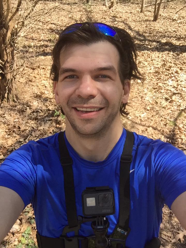
Shawn J. Gossman
Host
Shawn is the founder and host of the YouTube Channel, Hiking with Shawn as well as Hiking with Shawn LLC. Shawn hikes, backpacks and visits various forested areas in the Shawnee National Forest, local state parks and other areas promoting outdoor recreational activities to obtain video to show to locals and non-locals alike. Please support Shawn’s efforts by sharing this post and leaving a comment below.

Do you offer as a guide for hiking. I mostly have to travel alone and while I have family in that area I probably would like a guide so I do not have to hike alone. I walk 8 miles a day and I am 71 yo female. I have just been to Italy in a June and did much walking on incline.
I really don’t want to hike alone for safety reasons.
My wife and I do guide service on Saturdays. I charge $60 a person for up to 10 miles in one area.