Hiking with Shawn’s
Trail Guide Series:
High Knob Area
High Knob is a pretty special gem of the Shawnee National Forest to many different user groups. High Knob is very popular to the horseback and mule riding communities. High Knob is also a favorite of hiking and backpacking users. I have even seen cyclists enjoy a mountain biking experience along the high knob trails. It really is a special area with many things to see and explore. There are numerous trails located in the High Knob Area allowing for simple day hikes to multi-day backpacking trips. The River to River Trail also runs through the High Knob Area.
High Knob is a part of the Shawnee National Forest and is managed by the US Forest Service, Hidden Springs Ranger District. The closest community to the High Knob Area is Karbers Ridge. The closest bigger communities are Equality and Harrisburg.
A word of safety: Dangerous conditions exist in the High Knob Area. Hazards such as high bluffs, waterfalls and rocky terrains can be deadly if accidents occur. Rescue services may be hours away and cell phone coverage is often unavailable. The area is extremely remote and rugged. Venomous snakes also occur in this area including copperhead and timber rattlesnakes. Please use extreme caution when visiting the High Knob Area and always put safety first.
Directions and Trail Information
Check out this map to see the general High Knob Area and points of interest within it.
If traveling by car from Vienna, Illinois: From the intersection of HWY-46 and HWY-146, follow HWY-146 westward for 1.5-miles and turn left onto HWY-147 after passing the Interstate-24 entrance lane. Remain on HWY-147 for 12.7-miles until you reach the T intersection at HWY-145. Turn left onto HWY-145 and travel 16.4-miles to HWY-34. Turn right onto HYW-34 and travel 9.4-miles passing through Herod until you get to Karbers Ridge Road (Harbison’s Country Market is located at the intersection and is the last stop for fuel in this area). Turn left onto Karbers Ridge Road and travel 4.6-miles until reaching High Knob Road. Turn left onto High Knob Road and travel 1.7-miles to Knob Hill Ave or the road to High Knob Campground. Turn right and travel 0.8-miles until you reach the end of the road at the top of the hill where you will park. Parking is also available to your left just before the High Knob sign. Horse trailers should park at the campground.
The road traveling through High Knob Campground is public. You DO NOT have to stop and check in with the camp before visiting High Knob Picnic area. Please drive slowly and carefully through the campground as horseback and mule riders are often present. The campground office does sell cold beverages and snacks from time to time – feel free to stop by and purchase items. Shop local and support our businesses. Jo-Jo, the owner of High Knob Campground is very nice.
High Knob Hiker Only Trail: At the top of the picnic area (no equines allowed past the sign near where R2R crosses the road), the hiker only trail for the High Knob Area can be accessed. Trail numbers within this moderate nearly 1-mile loop are 105 and 105A. This trail is listed on the High Knob Pounds Hollow Multi-Day Hike Map that can be viewed on the Avenza Maps application for your smartphone. This trail will require some climbing up and down rocks, stairs, steep edges and forested trails. This trail follows the base of the High Knob bluff line and includes any views, cave-like cracks in the bluff and more. Recent work has been done to maintain this trail by the US Forest Service. If you’re practicing safe actions and would like a quick adventure-This trail is great for you. If facing the road with the parking lot and overlook sight behind you, I suggest taking the left trail and going clockwise.
High Knob Overlook & Picnic Site: Once you drive through the horse camp and up the hill-go all the way to the end where you can park on top of the hill. After parking, walk to where the picnic tables are and enjoy a beautiful scenic overlook. You can walk about the grounds on top of High Knob to see where the old fire watch tower once stood as well. You can access the tops of bluffs but please use caution as there are many fall hazards in this area.
Horse Trails: There are numerous horse trails in this area including Grindstaff, Snow Cone and Hurricane Bluff just to name a few. To access these trails, I recommend you use a map, GPS or an app on your phone. You can purchase paper maps from Friends of the Shawnee National Forest or at the Garden of the Gods Outpost. You can also download Avenza Maps for your smartphone as well. The OnXHunt Backcountry app for your smartphone also provides maps for these trails. Cell phone signal isn’t widely available in this area so remember to download maps on your phone for offline use to ensure that you stay on the correct trail. Not using a map of any kind may result in you getting lost due to the number of trails in the area.
Please remember that you will be sharing many of these trails with other hikers, equestrian riders and mountain bikers. All users should stop and yield to equestrian users while talking to them in a calm manner so that their horse/mule knows they are human and not a threat. A lot of equestrian users use the horse trails so be prepared to expect many muddy spots, significant trail damage and horse droppings which may make hiking and/or mountain biking very a challenge. But remember – many of the trails in the Shawnee National Forest wouldn’t exist if it wasn’t for equestrians.
Area Points of Interest
The High Knob Area is rich with various points of interest that caters to all forest users. One of the most prominent features is the scenic overlook at the top of the hill. This overlook provides a view of the Shawnee National Forest and southern Illinois rural areas. The overlook would be ideal for fall color photography and is often less crowded as other nearby spots such as Indian Point and the Observation Trail within the Garden of the Gods Recreation Area. The scenic overlook site also provides various picnic tables and the former foundation of the fire watch tower that once stood on top of this hill. If only the tower still remained, and we could access the top of it.
The Hiker Only Trail (105/105A) provides a view of the base of the actual bluff that makes up the High Knob hill. It is a moderate loop hike and less than 1-mile in length. This trail may only be used by those on foot. No equestrians, bicycles or motor vehicles are allowed on this trail. There are many things to see along this trail including bluff, long boulders, banding, cave-like areas within the bluffs, scenic overlooks, natural shelters, former CCC evidence and interesting rock formations. This trail would be ideal for a family looking for a more moderately rugged adventure without worrying about horses, bikes and motor vehicles.
The horse trails provide many different sites as well. If parking where the River to River Trail crosses the road, right before the official sign for High Knob, you can head down the R2R trail to the east and in less than a quarter of a mile, you can see a series of old cabins that were once homes to those who lived there before the forest was made. The first cabin (newer looking one) to your right soon after the road is on private property – please avoid that one. The next cabins (2 older ones on the left) are on public land. Please use caution when walking around these cabins as cave ins could happen, floors could break and there are multiple unprotected and deep open wells located near the cabins off of the trails. Continue on to other trails to see interesting natural springs, beautiful overlooks and awesome bluffs and rock formations. There are miles upon miles of trail to hike and ride in this area. You can also get to Garden of the Gods, Thacker Hollow and Pounds Hollow from these trails.
Area Safety and Important Information
Dangerous conditions exist within this area. Hazards included in this area are falls and slip hazards. Please exercise extreme caution when visiting this area especially if the area is wet or has wintry conditions within it. People have been serious injured and have even died from fall around this area. Please don’t become a statistic. Leave with good memories, not bad injuries.
This area is widely used by horse and mule riders. All users should always yield to horse and mule riders at all times. Stop, yield and speak to the rider in a calm tone so that the horse or mule will know that you are a human and not a threat. Standing still and being quiet may scare the horse and cause it to harm its rider by accident. Check out my Safety Guide for Horseback County for more information on how to safely share the trails with equestrian users whether you are hiking, trail running or mountain biking.
Venomous copperhead and timber rattlesnakes occur in this area. It is illegal to harvest, harass, injure or kill any snake in the National Forest. Please report such activities to US Forest Law Enforcement Officials. If you see someone holding a dead timber rattlesnake on social media, screen-print the browser window and report it to Illinois Department of Natural Resources or the US Forest Service – it is ILLEGAL and immoral. You can remain anonymous.
Poison ivy occurs in this area and will likely be physically encountered if you get off trail.
There are many trails in this area. It is highly recommended that you use maps, apps or a GPS device when recreating in the High Knob Area to avoid getting lost which could be easily done without such navigational tools.
Bring plenty of water and food with you when exploring this area as the trails are rugged with rolling hills and rocky terrain. Water sources are often completely unavailable in this area of the forest. There are no restrooms in this part of the National Forest.
Trash services does not exist in this part of the forest. Please practice Leave No Trace and pack out what you pack in. Help us keep our National Forest clean for all visitors.
The nearest major hospital is in Harrisburg. Equality Fire Department is the acting fire and rescue agency for this area and is made up of volunteer personnel. Rescue services could take several hours due to area remoteness, lack of cell phone signal and steep terrain. Please let someone know before you go, where you are going. Try not to hike alone and practice safety before recreation.
Always remember to Recreate Responsibly when visiting the High Knob Area.
Area Fun, Lodging and Food Information
For other outdoor recreation activities near the High Knob Area, check out Garden of the Gods Recreation Area for day hiking and non-electrical camping spaces and Garden of the Gods Wilderness Area for overnight backpacking and horseback riding. Pounds Hollow has a very nice beach and campground with electrical and non-electrical hookups. High Knob Campground and Double M Campground are the primary favorites for equestrian camping in this general area. Glen O Jones Lake is a great place for family camping, fishing and boating, kayak and canoe recreation and there is even a bicycle path as well.
Harbison’s Country Market is the only nearby gas station in the area. Check out Garden of the Gods Outpost for outdoor supplies, bigfoot swag, Shawnee National Forest merchandise, maps, souvenirs and some of the best ice cream in the southern Illinois area! Mitchellsville Country Store near Harrisburg also has fuel and great food as well.
For cabin camping in this area, we recommend Rim Rock’s Dogwood Cabins, Timber Ridge Treehouse Cabins and Shawnee Forest Cabins. Head into the little town of Equality to eat at the famous Red Onion or drive to the City of Harrisburg for some delicious pizza from Mackie’s Pizza. Harrisburg also reports sightings of a bigfoot and Tunnel Hill State Trail can be accessed from there for cycling and walking.
Watch the videos for the High Knob trail!
Below is a recent video that we filmed while enjoying this area.
Check out the High Knob trail gallery!
Enjoy these photos taken around this area!
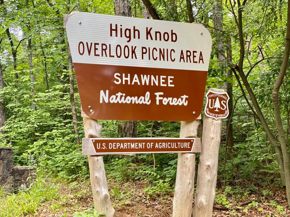
High Knob Sign
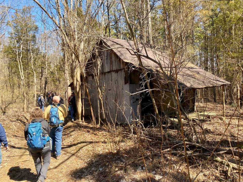
Old Cabin
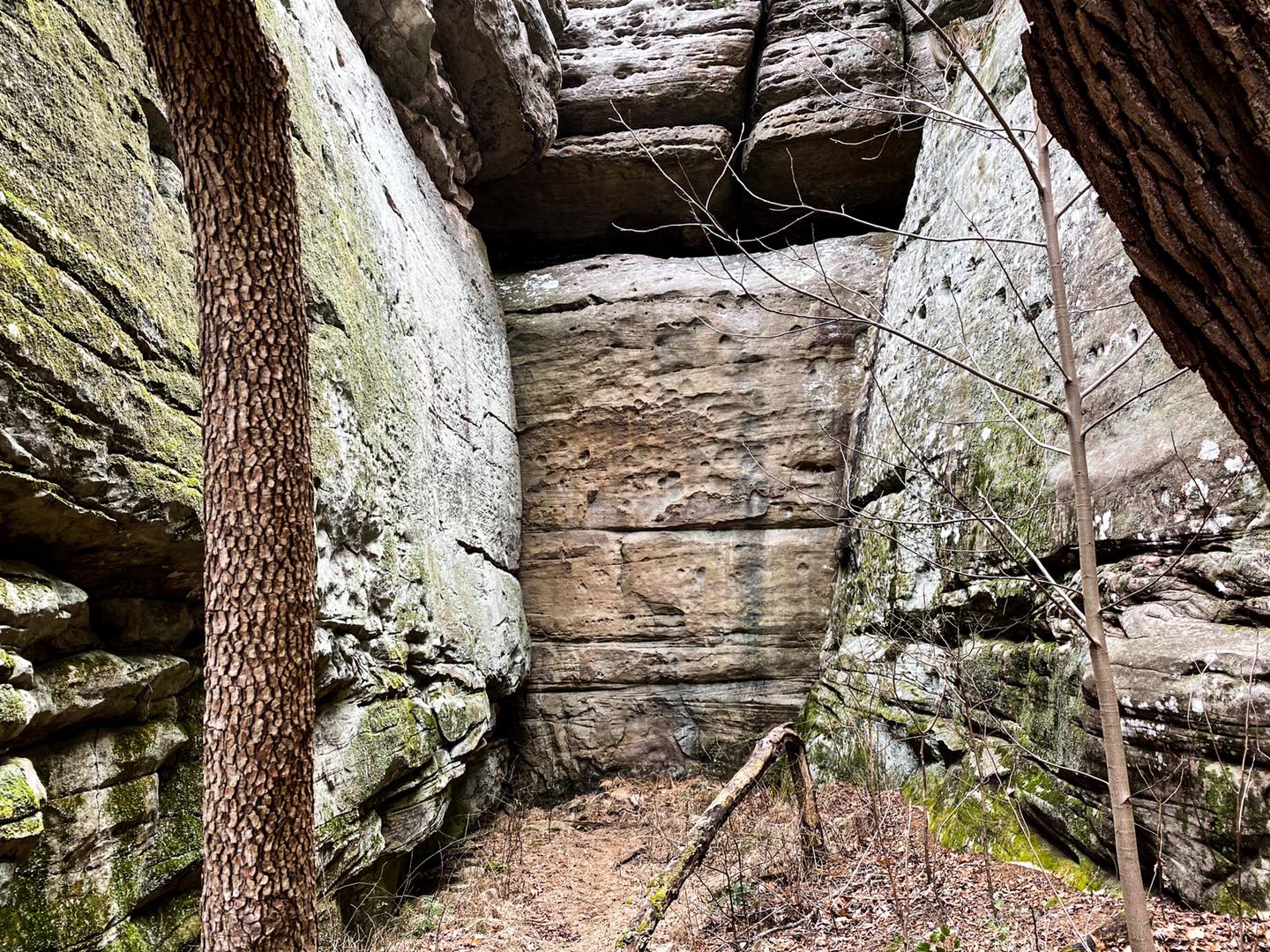
Bluffage around Hurricane Bluff
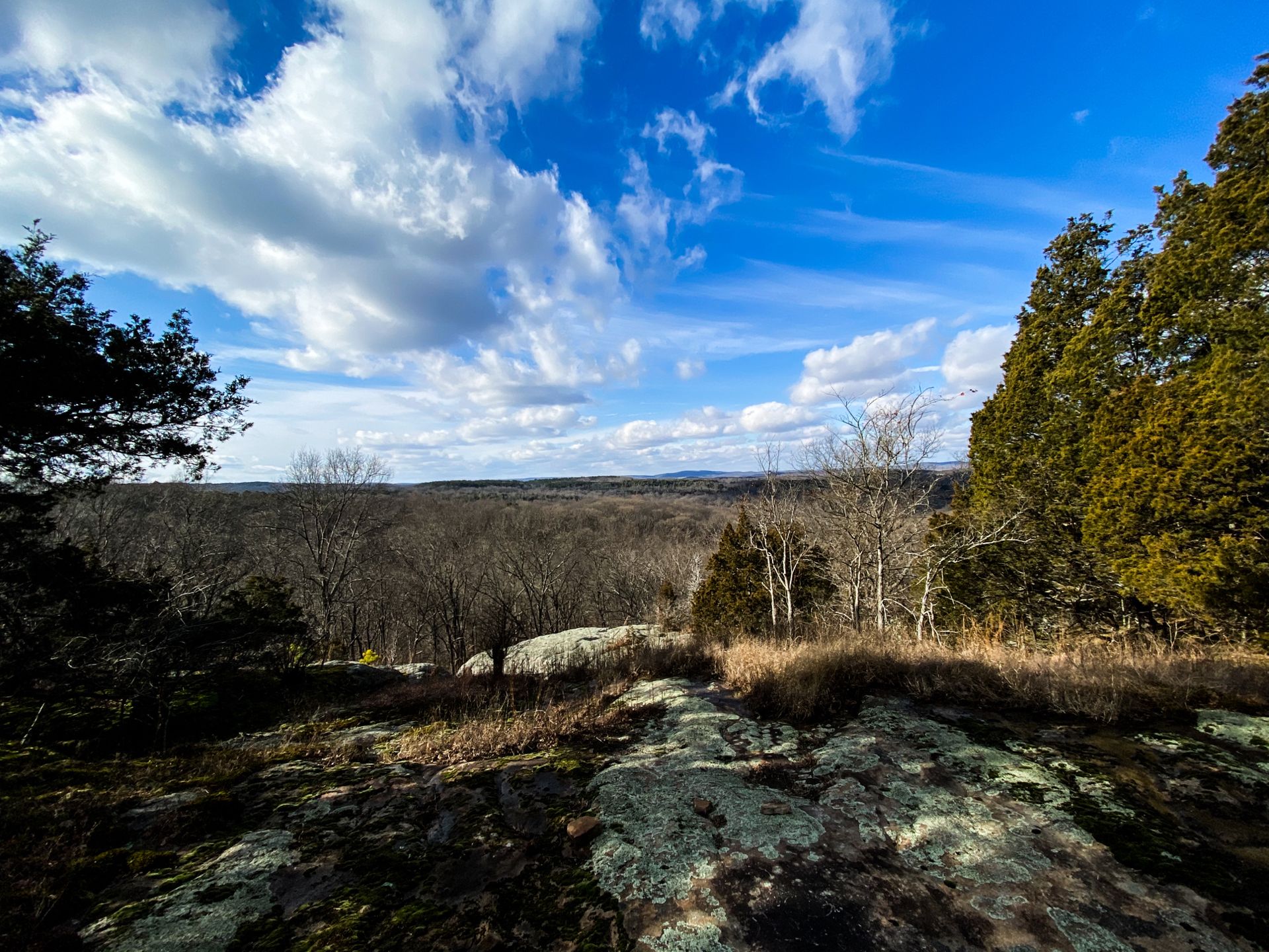
Hurricane Bluff Overlook
One last thing!
Filming the videos, taking the photos, editing everything and writing this article takes time and it’s all provided for free. Consider making a small monthly contribution to Hiking with Shawn by becoming an official Patreon supporter on Hiking with Shawn! You can also support us by purchasing official merch from the Hiking with Shawn online store. Lastly, please share this article and our videos and follow us on YouTube, Facebook, Twitter, Instagram and Tumbler for more free guides, videos, photos, contests and more!
Thanks for checking out this guide and please share it with others if you’d like to see more of them made!
Shawn J. Gossman
Host
Shawn is the founder and host of the YouTube Channel, Hiking with Shawn as well as Hiking with Shawn LLC. Shawn hikes, backpacks and visits various forested areas in the Shawnee National Forest, local state parks and other areas promoting outdoor recreational activities to obtain video to show to locals and non-locals alike. Please support Shawn’s efforts by sharing this post and leaving a comment below.