Hiking with Shawn’s
Trail Guide Series:
Jackson Falls
Jackson Falls in the Shawnee National Forest is a popular gem among many different user groups. There are numerous hiking and equestrian trails within and around Jackson Falls, it is a climbing and bouldering paradise, this is often a most preferred spot for chasing waterfalls, camping is allowed here and the nice gravel road to the site is perfect for gravel cyclists and jeepers to enjoy. Jackson Falls is truly a special spot in the Shawnee National Forest.
Before making your trip to Jackson Falls, we recommend you check out this Trail Guide about the area. In this guide you can expect to read about what you can see and do at Jackson Falls and how to get there. We will help guide you to following the right trails to the spots you want to see as well. And do make sure you check out the area surroundings listed in this article for amenities and other things to do.
Remember to always Recreate Responsibly when visiting Jackson Falls. For official information and alerts for Jackson Falls, please see the US Forest Service – Shawnee National Forest for more information.
HOW TO GET TO THIS TRAIL
Getting to Jackson Falls is easy for the most part but will require some special attention. See this map for the general area of Jackson Falls to help aid you in planning from where you are traveling from. Look at this Google Map for directions to Jackson Falls from Marion, Illinois / Interstate 57.
While on Ozark Road, look for Glen St Falls Road. There should be signs on each side of the road with directional arrows listing Jackson Falls. The road is a narrow gravel road that looks like someone’s driveway, but it is a road that everyone can use. The road does dead end on private property past Jackson Falls for your information.
As stated above, the road is gravel and narrow. There are rough areas and potholes present. Most vehicles should be able to access this road. However, portions of the road could be severely washed out if we have had significant rainfall in the area. The road is often untreated during snow and ice events. Please use caution on this road as other people will frequently use it and people do actually live along this road.
You will come to the trailhead when you see the creek cross the road. Unless we have had a lot of rain, crossing the creek with a vehicle should be okay as long as you take it slow. The parking lot in on your right. If the parking lot is full, you may need to drive across the creek and park on the side of the road up ahead. There are quite a few spots to park at.
On weekends and during the warmer months, this area is very popular and often crowded. For getting a good parking spot, it is recommended that you arrive earlier in the morning. This area is open all year long and is free to access and camp in. There is no running water and camping is considered dispersed with no electrical sites or maintained campsites. At the main trailhead parking lot, there is a vault toilet and signage with maps and information for the area.
There are no trash services at Jackson Falls. Please pack out what you pack in and help us keep our National Forest clean for everyone to enjoy!
TRAIL NAVIGATION INFORMATION
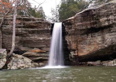
To access the main area of Jackson Falls, you want to take the trail at the main trailhead and parking lot on the left past the information sign going to the southwest. Take this trail (048) to where the creek falls into the canyon. This is the top of the main waterfall. Pending on how much rain has fallen, you will need to find a safe point for crossing the creek on the top side of the waterfall. Please use extreme caution here as conditions are slick when wet or during wintry seasons. People have fallen and died in this area – don’t be a statistic.
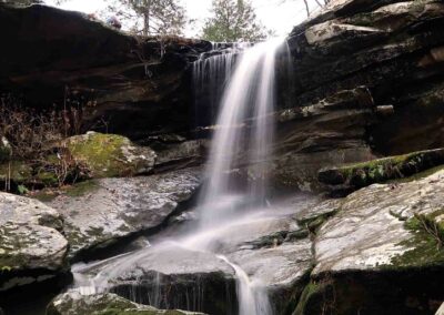
Once you are safely across the creek, take the trail that edges the top of the bluff. You will come to different forks, just maintain the trail close to the edge of the bluffs. Please watch your step here and be courteous of others using the trail. After hiking less than a quarter of a mile, you should pass over a wooden bridge with a waterfall below it. Cross the wooden bridge and hike about 30-60 feet and to your right is how you get down. There should be warning signage. This is called the Dog-walk and is the common way down into the ravine. Please be careful making your way down the rocks.
Notice the emergency backboard and first aid kit at the bottom of the dog-walk. This and other similar ones were installed in the area by an organization known as Beta Fund for emergency situations involving falls mainly from climbers but other trail users as well. Further up the road past the main trailhead is a helicopter landing area to take victims out of the area if they are hurt.
For horseback rider access or for hikers looking for a longer hike to Jackson Falls, it is recommended that you park at the East Trigg Trailhead (on Trigg Tower Road past Jack Davis Camp), hike/ride across the road onto the River to River Trail (001) and continue through the Tin Whistle, down to the creek, cross the creek and then take Trail 049 to your left to get to Jackson Falls. A round trip out and back from East Trigg is about 10-12 miles. A map or app is recommended here. A round trip from the main Jackson Falls Trailhead to the base of the main waterfall and back is about 3-4 miles.
Once you are down at the bottom of the dog-walk, take trail 049 back towards the base of the main waterfall. Hike around and then when you are ready to go, simply turn around and come back the way you came. Do note that Trail 049E will take you back towards East Trigg and away from the main area. At the main trail above the waterfall, if you go right instead of crossing the creek – that trail will eventually come to a dead end.
For navigating this area, we recommend the free app Avenza and using the maps for River to River Trail Map Bundle and Multi-Day Hiking Map Bundle. This application can be run on most smart phones and does not require cell phone services for it to work as it relies on GPS. This is trusted app or the US Forest Service and supporting organizations.
WHAT TO EXPECT TO SEE IN THIS AREA
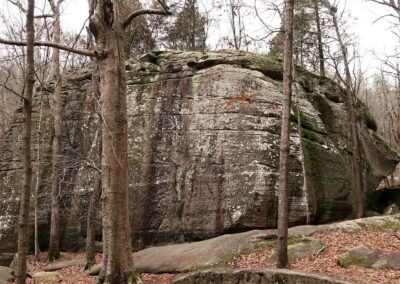
There is a lot to see at Jackson Falls. This area caters to many different types of forest user groups. Aside from hiking and backpacking trail opportunities, equestrians often use this area to ride their horses and mules in. This area is an official designated climbing and bouldering site, fully supported by the Illinois Climbers Association. There are multiple bluffs with climbing hooks and systems installed on them for safe rope climbing activities and many bluffs are also used for freestyle and bouldering climbing methods as well. Some mountain bikers have reported that this area is a great place to ride to from East Trigg and the gravel roads in there are could provide great opportunities for gravel cycling and jeep touring. Whatever recreation you plan to do at Jackson Falls, please ensure that you practice safety first and always watch your next step.
Jackson Falls is also a popular destination for chasing waterfalls. There are at least 3 (sometimes more pending rainfall amounts) waterfalls around the Jackson Falls ravine. The main waterfall is a very popularly features waterfall on many social media sites. While dangerous to get to, during wintry conditions, this area is also reported to be a good area for viewing frozen waterfalls. All the waterfalls and creeks within Jackson Falls are very rainfall dependent meaning that if there hasn’t been much rain, you should not expect significant waterfall activities.
The US Forest Service refers to the Jackson Falls area as non-maintained National Forest land. This means that at this time, it is not a designated or maintained recreational area. This means that you may freely camp within the Jackson Falls area. Along the main road, many camp sites have been established over the years. People also like to camp in the main ravine of the area as well. There is no fee for camping. Aside from the vault toilet at the trailhead, there are no services such as trash or water service in this area. Please pack out what you pack in and recreate responsibly by Leaving No Trace.
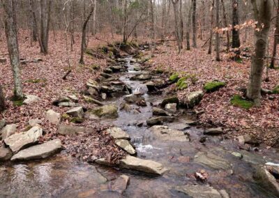
There are many bluffs, overlooks, cave shelters, scenic creeks and formations within the trails of the Jackson Falls area. It is a great place to spend the entire day hiking around and enjoying the outdoors that the area has to offer.
NEARBY THINGS TO DO IN THIS AREA
For other hiking and recreational opportunities in this area, we suggest you check out the nearby Bell Smith Springs for hiking, camping and swimming (no equestrian access here), Burden Falls Wilderness for hiking, chasing waterfalls and horseback riding and Millstone Lake for fishing, kayaking, horseback riding, camping and hiking. Other great spots near this area are Millstone Bluff, Trigg Tower and Sand Cave.
For great food near this area, we recommend Murphy’s Pit BBQ near Ozark for good BBQ and other great food. We also recommend Shotgun Eddy’s in Eddyville for great breakfast, lunch and adult beverages and entertainment. For camping in this area, check out Red Bud Campground for non-electrical sites, Hangout Campground for electrical sites and Hayes Canyon Campground for equestrian camping. The nearest hospital, hotels and major commercial services are in Harrisburg, Illinois.
EMERGENCY INFORMATION
Emergency services in this area can be obtained by dialing 911.
The emergency services who serve this area include US Forest Service Law Enforcement, Illinois DNR Conservation Police, Pope County Rural Fire Protection District and the Pope County Sheriff’s Office.
Please take safety seriously here as many people have fallen or became lost in this area. Due to the remoteness of the area, cell phone signal is often unavailable and first response to the area can take a while. Always recreate with another person or group and make sure you tell someone where you are going before visiting this area.
TIPS FOR THE TRAIL
- Bring plenty of water and snacks with your when visiting this area
- Never drink unfiltered water as many agricultural uses with chemicals is done nearby
- Poison ivy occurs in this area
- Venomous snakes occur in this area
- Avoid getting lost by always staying on the designated trail
- Private property is in this area, please do not trespass
- Consider downloaded Avenza and using the R2R Bundle or Multi-Day Bundle maps
- You can purchase paper maps from Friends of the Shawnee National Forest
- There are no trash services here – please pack out what you pack in
- Always put Safety First and always Recreate Responsibly when visiting
Watch the videos for this trail!
Below is a recent video that we filmed while enjoying this area.
One last thing!
Filming the videos, taking the photos, editing everything and writing this article takes time and it’s all provided for free. Consider making a small monthly contribution to Hiking with Shawn by becoming an official Patreon supporter on Hiking with Shawn! You can also support us by purchasing official merch from the Hiking with Shawn online store. Lastly, please share this article and our videos and follow us on YouTube, Facebook, Twitter, Instagram and Tumbler for more free guides, videos, photos, contests and more!
Thanks for checking out this guide and please share it with others if you’d like to see more of them made!
Shawn J. Gossman
Host
Shawn is the founder and host of the YouTube Channel, Hiking with Shawn as well as Hiking with Shawn LLC. Shawn hikes, backpacks and visits various forested areas in the Shawnee National Forest, local state parks and other areas promoting outdoor recreational activities to obtain video to show to locals and non-locals alike. Please support Shawn’s efforts by sharing this post and leaving a comment below.

