Tunnel
Hill
State Trail
Guide
Tunnel Hill State Trail is a 50+ mile rail trail in Southern Illinois.
The trail was once a bustling railroad line during the 1800s into the 1900s, back when there was a coal mining boom in the region. The railway transported coal and locally grown fruit from orchards around the area.
In the 1990s, the railway diminished in operation and was handed over to the Illinois Department of Natural Resources, which turned it into a rail trail.
Today, Tunnel Hill Trail is enjoyed by cyclists, runners, and walkers worldwide. Major sporting events even take place on the trail.
This trail was widely responsible for the creation of Hiking with Shawn. You can learn more about Tunnel Hill State Trail in my Collaboration with Rails-to-Trails Conservancy.
Tunnel Hill State Trail Maps, Apps, and Resources
Using Tunnel Hill Trail is pretty straightforward. But if you’re looking for maps, the best apps to use, and other resources for the trail – keep reading this section for more information.
Tunnel Hill State Trail Google Map
Check out my Google Custom Map below for the Tunnel Hill State Trail length and different stops along the way. I update this map as I discover more information to put on it.
Smartphone Apps for Tunnel Hill
There are many different applications available for smartphones on this trail. Some apps require you to pay to download a map for use in areas without cell phone reception.
I recommend you get the premium version for that reason.
There are many areas along the trail that will not have any cell phone reception.
These are some of the applications I’ve used and recommend you to use, too.
Trail Link – This is an application by Rails-to-Trails Conservancy, a National Organization that supports rail trails across the country. I recommend this app first because it helps Tunnel Hill and rail trails. I feel that supporting this organization is effectively supporting rail trails. I use and love this app.
All Trails – This is another excellent application for smartphone use. All Trails is trusted and, for the most part, reasonably accurate. I also use this app and have purchased the premium version of it.
OnXHunt – This app is a premium app that is good for exploring public land boundaries. So, I would mainly use this to explore state and federal public land off the trail. There is much private property around the area, and it’s essential to know and respect it.
Tunnel Hill Trail Resources
Some additional resources to the Tunnel Hill State Trail are available.
If you prefer a paper-style map, a generic one is available from the Illinois Department of Natural Resources.
Each trailhead for Tunnel Hill Trail also displays a map with historical and trail information on its sign kiosk. You can use that to help determine your location and route, too.
The official website for Tunnel Hill Trail is located on the Illinois Department of Natural Resources website.
I’ve previously created a guide for biking the trail as a beginner in case you’re interested in that information.
Tunnel Hill State Trail Adventure Planning
There is an adventure for everyone on Tunnel Hill State Trail. Whether you’re a beginner to advance cyclist, a runner, a hiker, or just want to walk with the kids or your pets – this trail was made for you to enjoy. Let’s check out some of the adventures you can enjoy today!
The Best Routes for Day-Use Biking
If you just want to spend a day along the trail, there are plenty of great routes.
Tunnel to Breeden Trestle: (5-Mile Round Trip) If you do not want to ride many miles, consider starting at the Village of Tunnel Hill and heading towards Vienna (south) on the trail. You’ll see the 500+ foot tunnel within a few minutes, and if you make it a 5-mile round trip, you can get even the Breeden Trestle, the longest trestle on the trail. You can also stop by Sandburn Junction for treats, bike rentals, and a greenhouse. This route is the best for beginner cyclists and those with young children. The ride to the trestle is downhill, but the grade isn’t too strenuous. There are plenty of benches along the way to stop and rest at.
Vienna to Tunnel Hill: (20-Mile Round Trip) If you are looking for a longer route with a lot to see, you should do this route. Vienna towards Tunnel Hill is the most popular route on the trail. On this ride, you’ll see everything: the tunnel, Breeden Trestle, other trestles, bridges, waterfall cascades, Sandburn Junction, railroad items left behind, old home sites, and plenty of bluffage, too! You’ll bike uphill to the Tunnel, but the downhill ride back is a great reward. As the most popular route, you’ll likely encounter other cyclists, runners, and walkers while you ride.
Vienna to Wetland Center: (26-Mile Round Trip) This is a great scenic ride with many of the Cache River Watershed. You can see various areas of swamps and wetlands. If you ride this route during the warmer months, note that you’ll likely see snakes along the way. Some snakes may be on the trail (please yield to them and give them plenty of room as you go around them). If you ride to the Wetland Center past the Karnak Trailhead, you can take a tour inside and even watch a video if you ask about it. If you’re like me and are fascinated with snakes, you’d like this section quite a bit. There are also creeks and the Cache River that you can look at to see other wildlife. I’ve seen otters in some of these creeks!
Vienna to Heron Pond Bike & Hike: (12-Miles of Biking/1.5-Mile Hike) If you’re looking for an adventure, I recommend this route. You can start biking from Vienna and heading south. As you make your way toward Heron Pond Lane, you’ll see plenty of trestles, swamps, and scenic creeks. Once you’re at the lane, take a right and ride to the end. Be careful as vehicles do travel on this gravel road. The trailhead and the 1.5-mile easy Heron Pond hike are at the end of the road. Make sure you bring plenty of bug spray for the hike. If you’ve never seen Heron Pond, you will fall in love with this place.
Harrisburg to Stonefort: (26-Mile Round Trip) This is a pretty route to ride. You’ll see various forested terrains, trestles, creeks, and some left-behind railroad items along the way. This route tends to have more open canopy areas, so be sure to use sunblock. I like this route when I want just to ride and get some exercise.
Harrisburg to New Burnside: (36-Mile Round) This route is like the Harrisburg to Stonefort Route above, but it adds some additional mileage. I like to ride it when I want a long bike ride exercise trip.
Harrisburg to Eldorado: (20-Mile Round Trip) This section is a route not many people ride. The portion of the trail in between Harrisburg’s main city to Eldorado is on the rugged side. There are a few potholes that you want to look out for. But I enjoyed this route myself. Muddy was an exciting spot with one of the smallest post offices in the country, and the Eldorado trails are excellent (and paved). I would recommend you at least do this route once. I’ll do it more than once, myself.
Karnak to Harrisburg (Century Ride): (100-Mile Round Trip) If you’re looking to do a Century Ride (100 miles), this is the route for you. Start at the Karnak Trailhead (south), ride to the end of the Harrisburg Trail (north), and ride back. That’s 100 miles! You will need to start early and prepare for that many miles.
The Best Routes for Hiking and Running
This trail is an excellent trail for running. Every year a Boston Marathon Qualifier Called Tunnel Hill 50/100 occurs on the trail.
Vienna to Shelby Road: (5.6-Mile Round Trip) This is an excellent run route that most people do when visiting the trail for running purposes. The terrain is uphill to the road and downhill back to the trailhead. The path is crushed limestone and goes over a few bridges.
Wetland Center 5K: (3.5-Mile Round Trip) This lovely 5K run starts from the Wetland Center and goes back to the Karnak Trailhead. You’re less likely to see many people from Vienna to Shelby Road along this route.
Harrisburg Paved Run: (10.10-Mile Round Trip) If you prefer a paved run away from cars, stick to the Harrisburg route. All of the trail in Harrisburg is paved and striped. The City of Harrisburg maintains this section of the trail.
Tunnel Hill 50/100 Routes: (50/100-Mile Round Trip) If you are interested in doing the 50-mile or 100-mile routes that the Tunnel Hill 50/100 race does, you can enjoy doing it. Make sure you plan correctly before doing these routes.
Tunnel Hill State Trail Bikepacking and Overnight Hiking
There are plenty of opportunities for bikepacking or overnight hiking along the Tunnel Hill State Trail.
Vienna to Karnak (Short Trip): (21-Mile Round Trip) Please call the City of Vienna to gain permission for overnight parking. This is a shorter bikepacking or overnight hiking route that is a little more than 10 miles a day. There is a campground located in Karnak right off the trail.
Harrisburg to Karnak (Long Trip): (90-Mile Round Trip) Please call the City of Harrisburg to gain permission for overnight parking. Starting from Harrisburg, you could do a much longer overnight bikepacking (or hiking) adventure nearly 100 miles in length. A side trip to the Wetland Center and the end of the Harrisburg trail portion should get you 100 miles if you require it.
Tunnel Hill State Trail Itinerary Plans
Preparing for a bike ride, hike, run, or overnight trip along Tunnel Hill State Trail often requires planning. The longer the adventure, the more planning will be needed to make the journey successful. Hiking with Shawn offers Itinerary Planning Services at a low cost. These plans include the best routes, lodging, dining, shopping, and sightseeing along the way you plan to visit. Get a plan from the people who know the trail the most.
Tunnel Hill State Trail Safety Information
It’s essential to stay safe while using the trail.
The following safety recommendations are meant to help you stay safe while using the trail:
- Share the trail with other users. Don’t block the trail – move over if someone else is coming at you or needs to pass.
- Stop at all stop signs and intersections. Yield to vehicle drivers.
- The railroad track that crosses the trail near Belknap is an unprotected crossing. Make sure you yield before crossing. It can take a train up to two in half miles before it can come to a complete stop in an emergency.
- Venomous snakes (including copperhead and cottonmouth) occur along this trail. Please watch for snakes and give them plenty of room. All wildlife is protected under state law along this trail.
- Hunting is not allowed on Tunnel Hill State Trail, but properties around the trail may have hunters during hunting season. Use caution during hunting season.
- To avoid most hazards, stay on the trail.
- Mosquitoes can be bad during the warmer months – bring plenty of bug spray.
- Most of the trail is shaded, but some canopy areas are open – bring plenty of sunblock.
- Poison ivy and ticks occur off the trail.
- During and after severe weather, there could be eroded spots (from heavy rain), trees down, and other debris (from wind) along the trail. Please use caution.
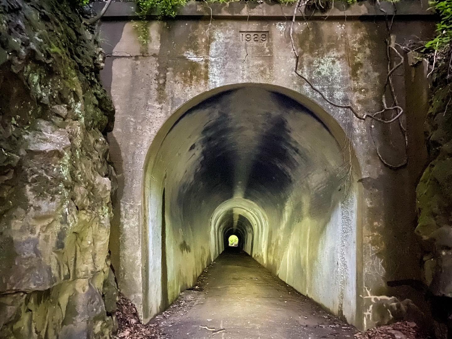
- The tunnel is usually extremely dark in the middle. A light is best for use in the tunnel. To promote safety, ensure everyone is out of the tunnel before you go through it.
- Dangerous conditions exist within this area. Please use caution around bodies of water, creeks, rivers, and edges of cliffs and bluffs.
- The River to River Trail crosses Tunnel Hill State Trail between Vienna and Tunnel Hill. Hikers and horseback riders may cross the trail. Please practice safe trail-sharing activities when you encounter equestrian and hiking users.
- Motor vehicles are never allowed on the trail. eBikes are fine as long as they are not modified to be faster than what they’re governed for by the manufacturer.
- Much of the trail isn’t lit up after dark. A light is needed for traveling on the trail after dark.
- Bring plenty of water with you while using the trail. The water fountains at each trailhead are not guaranteed to be turned on. Water boil orders or maintenance may restrict their use.
- Bring plenty of snacks and food while using the trail. Most trailheads are in small communities that do not offer shopping locations.
- Only ride, hike, or run the amount in which you’re physically able to do.
- Mostlypart, there aren’t many dog-chasing-people encounters along the trail. If this occurs, tell the dog “NO” and use your water bottle to spray water at it. Don’t try to hit the animal.
- Deer and other wildlife are common along the trail. Please watch for and yield to all wildlife using the trail.
There will be plenty of other safety situations you might run into that are likely not listed here. In the end, use common sense and always put safety first. No matter where you are on the trail, if an emergency occurs – call 911.
Tunnel Hill State Trail Group
Are you a member of the Tunnel Hill Facebook Group? You should be! Nearly 2,000 people are actively posting on the group. If you need help with the trail, have questions, want to see photos, or post photos and videos – then we recommend you join the group. It’s free, of course, and fun for everyone of all ages!
Tunnel Hill State Trail Towns and Services
There are quite a few towns along the trail. Some of the towns have services while others do not. Knowing these towns and their services is essential when planning to visit the trail.
Karnak
Karnak is where the southern terminus of the Tunnel Hill State Trail is located. The trailhead features water, restrooms, parking, bike repair tools, bike rack, signage, and picnic tables.
A trail branch goes to the Wetland Center for the Cache River State Natural Area.
This village was established in 1905 when the post office was created. The village was named after Karnak of Egypt, as many other areas around Southern Illinois are known as Little Egypt.
The only service located in Karnak is a Dollar General Store. Please use caution is biking/hiking to this store.
The village owns a campground along the trail where users can stay (for a fee). There are non-electric and electric sites available.
There are other sightseeing opportunities in the area, including the Henry Barkhausen Wetland Center and Big Cypress Access.
Belknap
Belknap is a small village located along the trail. There is no parking availability along this portion of the trail. There is a bench for resting and an information sign.
Belknap was established in 1873 and was a Big Four Railroad railway stop. According to Wikipedia, it was named after the Secretary of War, William Worth Belknap.
There are no services along this trail.
Vienna
Vienna is the location of the Tunnel Hill State Trail Headquarters, which is located at the trailhead next to the City Park. Vienna is the most popular trailhead of the entire trail and often the starting point for most trail users.
There are many features at this trailhead. Water, adequate parking, picnic tables, information signage, and restrooms are available. The park has bathrooms with running water.
The Tunnel Hill HQ is usually open during the daylight hours through the week and sometimes during the weekend. There are restrooms, brochures, and a Museum within the facility.
Vienna has a rich history. It was initially an Indian trading post in the 1800s. The Trail of Tears is a settlement where Native Americans were forced from their homes and marched to reservations. Many of them died along the way. Vienna is the county seat of Johnson County.
Multiple services are available in Vienna, including gas stations, restaurants, fast food, grocery stores, and other things. Visit the Vienna Visitor Center (Foreman Depot) next to the park and trailhead for more information on these services.
Tunnel Hill
Tunnel Hill is an unincorporated village in Johnson County.
This trailhead includes parking, water, restrooms, bike racks, information signage, and picnic tables.
The history of this community was active during the railroad day in the late 1800s and early 1900s. What was likely a vibrant community is merely a living ghost town in modern times. The town is the namesake of the trail, and the 500+ foot long tunnel is located a few minutes from the trail.
The only service in Tunnel Hill is Sandburn Junction, accessed from a gravel road or the trail going south after the tunnel. Sandburn Junction has a general store with bike rentals, ice cream, drinks, produce, and veggies that is always open. There is also a nursery that is open during the daylight hours. The general store is an old building once used during the railroad days. The information signage at the trailhead shows a past photo and provides more information.
New Burnside
New Burnside is a village along the trail located in Johnson County.
It was named after Ambrose Burnside, who was a Civil War general. The village was founded in 1872 and was active during the railroad boom. After the railway was abandoned, the town and its population diminished like the other communities along the trail.
The trailhead features restrooms, water, picnic tables, bike racks, and information signage. There is a small parking lot for the trailhead. The bathrooms here are usually locked, and the water is often turned off.
There are no services in New Burnside.
Stonefort
Stonefort is another village along the trail located in Saline and Williamson counties.
The trailhead has parking, restrooms, water, bike racks, and picnic tables.
Settlers started migrating to Stonefort during the early 1800s. The town is named after a Native American structure called a nearby Stonefort. The Stonefort structure is located on the Shawnee National Forest property. The town was initially located near the structure but was moved closer to the railway at some point.
There is a railroad museum located next to the trailhead.
There are no services in Stonefort.
Carrier Mills
Carrier Mills is located in Saline County along the Tunnel Hill State Trail.
The trailhead offers parking, restrooms, picnic tables and benches, water, and information signage.
Hampton Pankey was the first known settler of Carrier Mills and one of the earliest settlers in Saline County, arriving around 1804. Settlers began building houses around 1811 to protect themselves from opposing Native American forces. A grandson of Hampton was also a founder of the nearby City of Harrisburg. The closing of railways and mining operations effectively led to the town’s declining population and economic structure.
Carrier Mills has a few services, including a gas station, a grocery store, and a Dollar Store.
Harrisburg
Harrisburg is the largest city connected to the Tunnel Hill State Trail.
There are a few rest areas and trailheads for the trail located within Harrisburg’s city limits. The trail is mainly paved through Harrisburg and maintained by the city. Restrooms, benches, parking, and water are all available in the town.
The history of Harrisburg started in 1847 when it was founded. It was named for John Alexander Harris, a local farmer who farmed and lived around where the city square is now located. Harrisburg is the county seat of Saline County. Harrisburg is a stable economic community but is said to have once thrived during the coal mining and railroad booms. After the mines and railroad shut down, the town did start to diminish. However, in modern times, the City appears to be doing well.
The City is known for its annual Sasquatch Festival, which celebrates Sasquatch or Big Foot but also has music, food, entertainment, and more.
Multiple services include large retail stores, fast food, grocery stores, great mom-and-pop stores, and more.
Muddy
Muddy is an unincorporated community located north of Harrisburg along the Tunnel Hill State Trail.
Parking is available in Muddy, but there are no other features for trail users.
The history of Muddy is that the area was once used for settlement during the coal mining boom. It was likely named after the Big Muddy Coal Company.
There is a tiny post office located across from the new post office that you can view. This used to be one of the smallest post office facilities in the state. There isn’t much historical information about this post office.
There are no services in Muddy.
Eldorado
Eldorado is not technically a town along Tunnel Hill State Trail. However, many trail users will also ride into the town to use their bikes/walking paths. So, I felt like Eldorado deserves an honorable mention in this guide.
The bike path was once railroad tracks which to me constitutes their paths as rail trails. I’m unsure if they’ve officially designated them as a rail trail system, but if not, they should because, legally, they can be a rail trail system.
The history of Eldorado is fascinating. The town’s names sound Spanish in nature. But it is a combination of the two names, Judge Samuel Elder and Joseph Read, who were the town’s founders. The town was initially spelled Eldereado but later changed to Eldorado. The town was founded in 1870. The town gave relief efforts during the Flood of 1937. The town has suffered many economic downfalls, including mines and Roundy’s Distribution Center closure.
Some services are available in town, including restaurants and a gas station.
Ghost Towns of Tunnel Hill State Trail
A few Ghost Towns users of the trail will pass through. Most of these Ghost Towns have nothing to show besides a few foundations and signs of past railroad usage.
Forman was located around Heron Pond Lane, which the trail crosses. The Forman Depot was moved to Vienna City Park and now serves as the Vienna Visitor Center. There is a small church located on Heron Pond Lane that has been reopened for services.
Parker City (or commonly just Parker) was located between Tunnel Hill and New Burnside. Some foundations are visible on a bench next to a sign with no information. The foundation is best seen when the leaves are off the tree during the winter. Parker was once a prosperous community with a bank, hotels, and a thriving population. When the mines and railroad diminished, the town was abandoned and remained a Ghost Town.
Other Ghost Town names along the trail include Rago, New Castle, and Bender. However, little known information is available about these ghost towns’ history. They likely were abandoned after the railway operations started declining.
What can you spot along the Tunnel Hill State Trail during your next visit?
Recommended Gear for Tunnel Hill State Trail
The trail is relatively easy to use for most people. However, sometimes you might want some gear and equipment recommendations for your visit.
Recommended Gear for Cyclists
The majority of the trail is made up of crushed limestone. Some areas are gravel. Some areas (especially around Harrisburg) are paved. The best kind of bike for the trail is a hybrid-style bike, a gravel bike, or a mountain bike. A road bike is not recommended.
Cyclists should wear a helmet for safety. Other apparel to increase comfort on the bike includes cycling gloves, padded bike shorts or tights, a bike jersey, and comfortable shoes. While most of the trail is in the shade, a cycling cap and sunglasses might also be ideal.
Cyclists should bring plenty of water and snacks.
Recommended Gear for Runners
Runners should wear comfortable running shoes and clothing. Synthetic clothing is best as it wickers sweat and moisture from the body and dries quickly.
Runners should bring plenty of water and snacks.
Recommended Gear for Hikers
Hikers should wear comfortable hiking shoes or boots. Hiking or athletic-specific clothing is also recommended for using this trail.
Bring plenty of water and a snack.
Tunnel Hill State Trail Q&A
Let’s examine some of the trail’s most common questions and answers.
What’s the History of Tunnel Hill State Trail?
In the late 1800s, the railway was established by Civil War General Ambrose Burnside. The Village of New Burnside was named after General Burnside. The railway was named Vincennes and Cairo Railroad after terminuses located in Vincennes, Indiana, and Cairo, Illinois. The railway was used by passenger trains and coal, salt, wood, and local orchard shipments.
The railroad changed hands throughout the years and was a part of the Big Four, consisting of Cleveland, Cincinnati, Chicago, and St. Louis lines often called CCC & St. Louis. The last railway company to own the line was Norfolk Southern.
In 1991, the Norfolk Southern Railroad gave the railway right-of-way to the State of Illinois. The Illinois Department of Natural Resources proposed that a rail trail be created. There was a local backlash as people feared that criminals and other unfriendly persons would use the trail. However, the plan to develop the trail was pushed through.
The first portions of the trail opened to the public in 1998. The trail was completed in the fall of 2001.
What’s the Best Bike to Ride on Tunnel Hill State Trail?
The best type of bicycle to ride on Tunnel Hill State Trail is a hybrid-style bike or a gravel bike. Mountain bikes could also be used as well as larger tire eBikes. Gasoline-powered bicycles or “homemade eBikes” are prohibited from using the trail.
The trail is mainly made up of crushed limestone. Using a road bike is not recommended.
Is Camping Allowed on Tunnel Hill State Trail?
Camping is generally not allowed along the Tunnel Hill State Trail. There is a campground right by the trail in the Village of Karnak, where the southern terminus of the trail is located.
The trail passes through portions of the Shawnee National Forest. It crosses the River to River State Trail, which could be used for dispersed camping outside of recreational and natural area designations.
The privately owned Shawnee Forest Campground is located near the trail in Vienna.
The trailheads for the trail are day-use only.
How Long is Tunnel Hill State Trail?
According to Google Maps, the trail is 50.8-miles in length from the southern terminus at Karnak to the northern terminus at Harrisburg.
If you add the Wetland Center branch, the length is 53.6-miles.
The Eldorado extension is 4.2-miles from the additional trail.
The total distance, including Eldorado, is 58 miles.
The Illinois Department of Natural Resources website for Tunnel Hill State Trail says the trial is 45 miles. This may be because they don’t include the Harrisburg section. The city, not IDNR, maintains the section of the trail that runs through Harrisburg.
How Hard is it to Bike Tunnel Hill State Trail?
The trail has an elevation gain of 1,108-foot according to All Trails. For the most part, the trail is easy to ride. The trail is mainly made up of crushed limestone. In Harrisburg, the trail is paved. There are some spots where gravel has been used to repair erosion.
As a former railway, most of the trail has gradual inclines and declines.
It is mainly uphill from Vienna to Tunnel Hill and begins to go downhill from Tunnel Hill towards Harrisburg.
The trail is mainly shaded, but there are some areas where the canopy is opened up, and the sun can reach in.
The trail should be easy for most groups, from beginners to advanced.
Are there any Bike Rentals around Tunnel Hill State Trail?
Sandburn Junction near the Village of Tunnel Hills offers bike rentals. The bikes are hybrid-style, and most have reflectors and baskets. Most of the time, renters use a payment honor system to rent bikes. Closed-circuit television (CCTV) is being used to monitor the bike rental area.
Are there any Bike Shops Near Tunnel Hill State Trail?
The closest bike shops to the trail are The Bike Surgeon in Carterville, Illinois, and Bike World in Paducah, Kentucky.
Thank you for checking out my Tunnel Hill State Trail guide in southern Illinois. This rail trail is worth checking out and is favored by many locals and visitors. If you’ve enjoyed this guide, please consider sharing it with others whom you might think would appreciate it.
Watch the videos for this trail!
Below is a recent video that we filmed while enjoying this area.
Check out the trail gallery!
Enjoy these photos taken around this area!
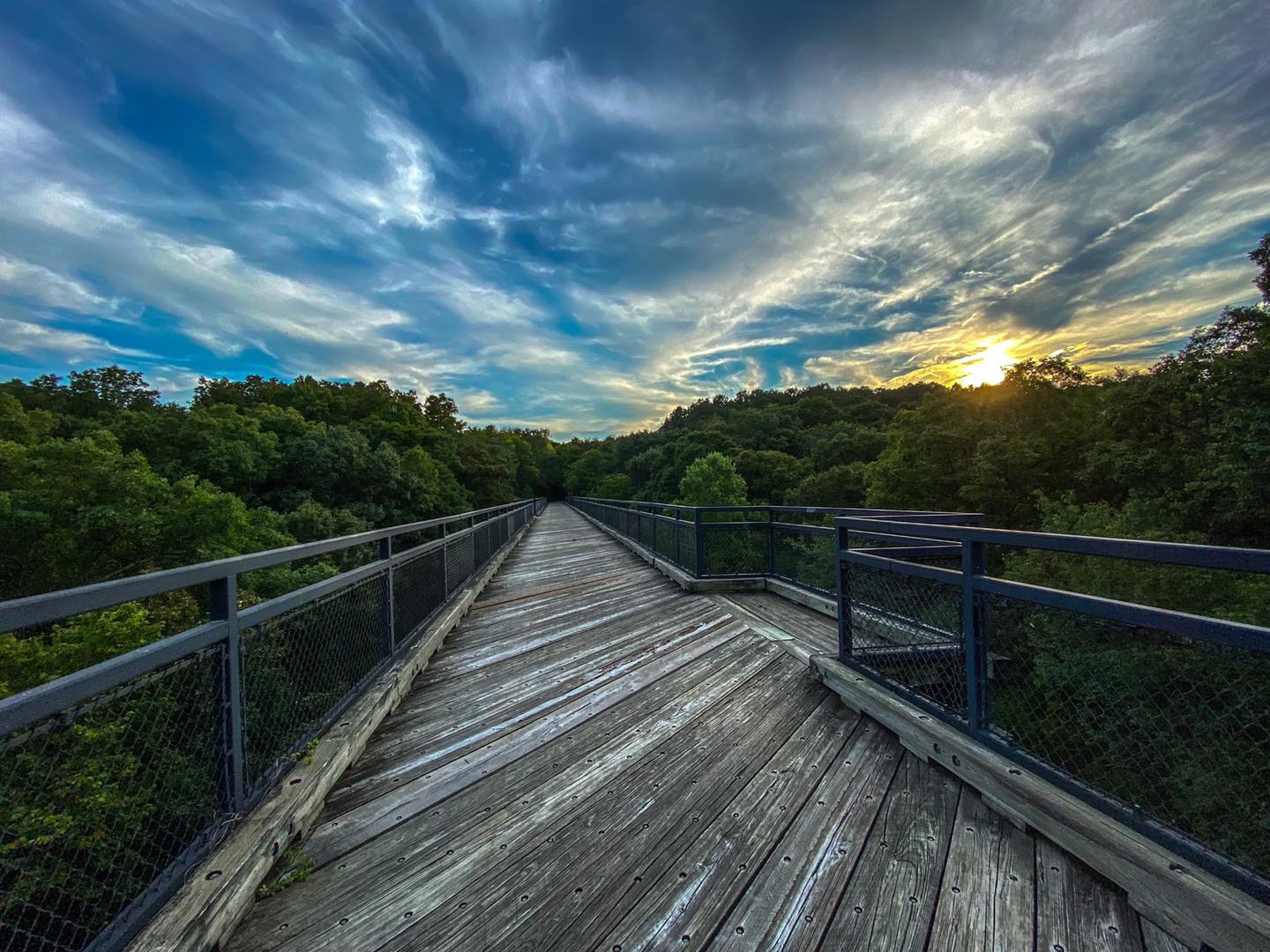
Breeden Trestle
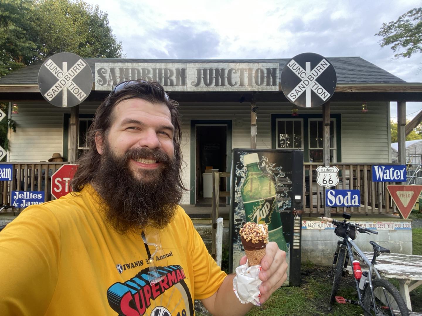
Sandburn Junction
Tunnel Hill State Trail
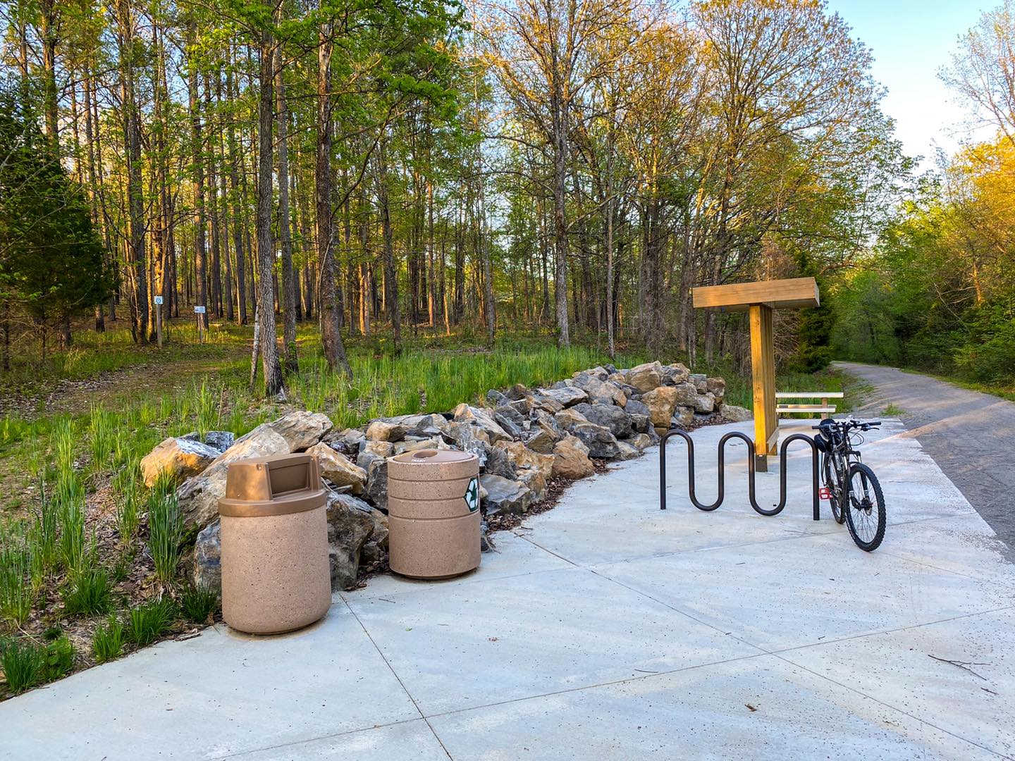
New Rest Area
Please Support Hiking with Shawn
Alrighty folks, I hope you have enjoyed this content. I provide it for free and it takes a while to create. If you would be so kind enough to support my efforts, you can do so by sharing this post with others, especially on social media. Be sure to subscribe to my YouTube Channel to see my latest videos, shorts and live streams. Follow me on Facebook, Instagram, Twitter and TikTok for unique content that you will only find on those pages. You might also join my Southern Illinois Hiking & Outdoor Resources Group on Facebook, too!
You can also support me by becoming a Patreon Supporter for as little as $3/month and you can cancel anytime (no contracts or catches). Patreons get access to extra features, exclusive articles, sticker packs, gifts and more. Consider buying official Hiking with Shawn Merchandise as another way to support me. I spend a lot of money on Hiking with Shawn and because of extremely high public land permit fees, I make very little money in return so everything helps.
Thanks again for checking out another one of my articles and until next time, I’ll see you on the trail!

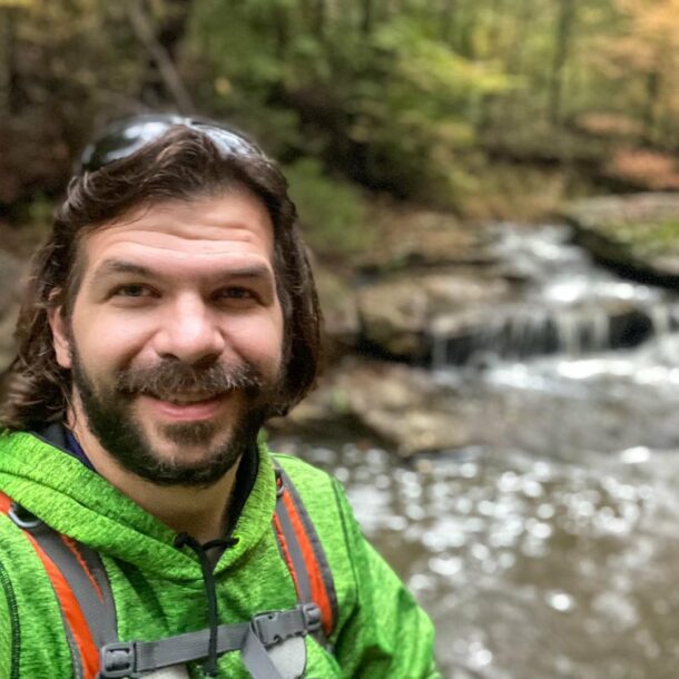
Shawn Gossman
Founder, Hiking with Shawn
Howdy folks! My name is Shawn Gossman and I founded Hiking with Shawn. I’m an avid hiker, cyclist and outdoorsman here in the Shawnee National Forest. I was born and raised in Southern Illinois and never want to leave. Click here to learn more about Shawn Gossman