10 of My Favorite Waterfalls in Southern Illinois for 2025
Everyone is always asking me about my favorite waterfalls in Southern Illinois!
I figured it’s time to list them, at the very least, in a top 10. I chose a top 10 because they’re all my favorites, but that’s not a good answer. So, I’ll at least give the 10 favorite waterfalls I’m heading to after a good rain.
That’s the thing, Southern Illinois waterfalls are heavily dependent on the amount of rainfall we’ve had.
If we haven’t had a lot of rain, there will likely be no waterfalls. If we’ve had a ton of rain, it’s going to be waterfall central out there. If the creeks are full and flowing, then that is a good sign that waterfalls will be in the area of that creek.
Keep in mind that waterfall chasing and photography are something where safety is a must.
Many people in Southern Illinois have fallen while chasing waterfalls. Some have died as a result. Don’t become a statistic for my next safety article, and instead, practice common sense safety when getting around these waterfalls.
Now on to the list of my favorite waterfalls in Southern Illinois.
These Are My Person Favorite Waterfalls in Southern Illinois
These are my favorite waterfalls in Southern Illinois, but they may not be yours. There are too many to list, but these are my favorites because they’re scenic and beautiful to see when they’re roaring.
1: Lost Canyon Waterfalls

Lost Canyon Waterfalls are a series of waterfalls located in a single area of Little Grand Canyon. It’s an area not too many people hike to because it’s a bit off the beaten path. There are some beautiful waterfalls at this location, however.
To reach this spot, it’s best to use a topographic map or app. The coordinates of the area where these waterfalls are at 37°40’27.5″N 89°24’14.4″W. Most of the time, I take a faint trail to the left on the Little Grand Canyon loop just past the trail in from the restroom side.
This hike is rugged, and the trail is no longer maintained. It was once a road. During the summer months, timber rattlesnakes are present.
2: Piney Creek Waterfall

Piney Creek Ravine isn’t just a trail leading to Native American Rock Art. There are also many great waterfalls located along the designated trail, particularly when the area is very wet. Some of these areas will require creek crossings, so be sure to take that into consideration.
Piney Creek Ravine is near Ava, Illinois, in Amish Country. Take the trail counterclockwise to see most of the better waterfalls, including the trail that goes to the right just before you cross a creek. Please practice safety as the ravine will flood during exceptionally heavy rain.
When it is very wet, this trail becomes fairly difficult. You’ll have to cross creeks, and some could be deep with a lot of debris in them. In the summer months, the timber rattlesnake occurs in this area.
3: Double Falls

Double Falls is among my favorite waterfalls in Southern Illinois because it’s so remote. It features two waterfalls that cascade down into a canyon, surrounded by beautiful bluffs to admire. There are no trails in this area, and it’s surrounded by private property aside from where you go in at the road.
The waterfall area is located at the following coordinates: 37°34’13.0″N, 89°11’26.2″W. To access the waterfall, you will need to park on the side of the road and bushwhack through the surrounding area. During the summer months, this can be a chore, and you’ll likely be covered in ticks afterwards.
This area is rugged and remote. The descent is difficult and extremely hazardous when wet. I would like to note that some people fell here a few years ago, and it took several hours to rescue them. Therefore, please exercise extreme caution when visiting this waterfall area.
4: Bork Falls

Bork Falls is a waterfall that’s a part of Ferne Clyffe State Park, but it’s located on a remote section of the park away from the main park. It features a creek that crosses the road and a large waterfall with a substantial pool at its base. It’s near many great trails, so you could make a nice day of hiking out of it if you wanted to.
Reaching this waterfall is fairly easy. You take Regent Lane from Goreville Road to 37°32’30.3″N 89°01’15.9″W. Take it easy on Regent Lane as the road is narrow, often eroded, and people live on it. When the area is really wet, you will have to cross a flowing creek on the road, but it has a rock bottom.
It’s harder to reach the waterfall by vehicle than it is to reach the fall itself on foot. Park at a little parking lot past the fall and take the left trail down, following the base of the bluff parallel to the road. The hike is very short to the waterfall.
5: Dutchman Lake Waterfalls

Dutchman Lake may just look like a lake, but it’s so much more. Not only does that River to River Trail run through it, but it’s also home to amazing rock formations, deep cave shelters, and some of the best waterfalls the Shawnee National Forest has to offer. We love chasing frozen waterfalls at this location.
The main waterfalls are in this particular area, 37°29’47.4″N 88°54’47.4″W. You park on the side of the road with the forest to your right and the lake in front of you, and then walk up each creek to find amazing waterfalls. The second and third creeks will have the better waterfalls.
It’s rugged. There are no actual maintained trails to the waterfalls. There are a lot of trees, rocks, and steep sections that you’ll have to overcome to reach these falls at times, but it is easier to hike during leaf off.
6: Bulge Hole Waterfalls

Bulge Hole is one of my favorite places to chase waterfalls because I discovered it on my own during a particularly wet day, and there were so many falls that I was overwhelmed. It’s best to visit after a week or two of heavy rain if possible. On a good day, you might see 20 to 30 waterfalls of different types and sizes.
The trail starts at these coordinates 37°30’06.2″N 88°53’19.2″W, where you park on the side of the road and follow the forest service road to your west. Hike past the power lines and past the Bulge Hole Sign to look for a faint trail to your right. A topographic map will be needed to find the canyon, which features numerous waterfalls and a large cave shelter (you’ll be amazed).
There are no designated trails in the area, and the faint user trails are often overgrown, making them a challenge to hike through. It can be difficult to get down into the canyon, especially when it’s wet. This is definitely not an area for beginners.
7: Easter Basket Waterfall

Easter Basket Waterfall is a great waterfall and hiking area located in the Cedar Wonders or Gum Springs area. It always reminds me of Joe Littleton, a local hiker and friend who has probably been everywhere I’ve been. The whole area offers several waterfalls, rock formations, a small natural arch, and more.
The waterfalls can be reached by traveling to the general area of these coordinates: 37°30’26.1″N, 88°46’47.1″W. To access the waterfalls, take the River to River Trail from the Gum Springs Trailhead, located off Gum Springs Road, and follow other trails branching off the main trail. This is a place where it’s easy to get turned around, so I recommend using a map or app to help you navigate it.
For the most part, there are designated trails that lead to all the best attractions in this area. However, it is a horseback riding country, and the trails do suffer from significant horse damage. Because of that, it can be moderately rugged, and you’ll probably get muddy, so wear some clothes you don’t mind getting filthy and have some fun.
8: Crevice Falls

Crevice Falls is located in an area commonly known as Packentuck, which is a tract of Shawnee National Forest butted up against Camp Ondessonk. There are three really nice waterfalls in the area, but Crevice Falls, in my opinion, is one of the better-looking ones. But while you’re there, be sure to follow the trails to check out the other waterfalls as well.
The coordinates 37°31’50.7″N, 88°44’11.7″W will take you to the trail on Packentuck Road, located to your left (east) after parking on the side of the road. Follow the trail to the canyons (it’s best to use a topographic map or app) to view the waterfalls. Please ensure you sign in at Camp Ondessonk if you plan to also cross into their property (excluding camping season).
This trail is best used when the area has received a lot of rain, but it will require a few creek crossings. The trails are generally well-maintained, but not as well-maintained as others, so they can be challenging during the summer months. Crevice Falls can be difficult to reach, so please use extreme caution.
9: Splatterstone Falls

Splatterstone Falls is situated in an area known as Jackson Hollow, which is located near Jackson Falls. It features a tall waterfall that strikes the top of a large rock, which gives it the name Splatterstone Falls. The whole Jackson Hollow area is worth exploring, but best done during the leaf-off months.
This waterfall is located at 37°30’18.6″N 88°41’49.2″W. Typically, when we visit, it’s during leaf off, and we get there by exploring off-trail. You’ll want to use a map with topographic features so you can gain an understanding of the lay of the land and determine where waterfalls like this are located.
Reaching this waterfall will likely be challenging for most, especially those not accustomed to rugged terrain. There are no officially maintained trails in the Jackson Hollow area, and it would be very difficult in the summer months. I recommend going during leaf-off and after we’ve had a lot of rain.
10: Jackson Hole Waterfall

Jackson Hole is another waterfall area we commonly visit when snow covers the ground, and everything is frozen. It features several waterfalls in a single area that are worth checking out, whether they are running or frozen. Just be careful, as this area can be extremely dangerous, whether it’s wet, ice, or even dry.
Getting to this fall is a challenge. Take Mustang Lane (Eddyville, IL area) to where the trail starts on your right (the road is really narrow and rough). Take the trail past the horse highline and to the sign. Make your way down using a topo map or app that shows the easiest way down (tighter the contour lines, steeper it will be).
The road to the waterfall is rough and often requires a 4×4 vehicle for driving. There is no real trail down to the waterfall; that’s a short hike, so you’ll have to bushwhack down the bluff, which can be very challenging. I would not recommend doing this in the summer months.
Final Thoughts
I hope you’ve enjoyed this list of my favorite waterfalls in Southern Illinois.
I want to remind you of the importance of prioritizing safety first. Many people have lost their lives chasing waterfalls in nature. They did that because they made bad safety decisions, which resulted in death. Please ensure that you always prioritize safety so you can continue to enjoy these special places.
I’d love to hear from you. What are some of your favorite waterfalls in Southern Illinois that didn’t make it on this list?
If you’ve enjoyed this article and would like to see more like it, please consider supporting me by making a one-time donation or becoming a monthly supporter on my Patreon Page, which offers exclusive features.
Be sure to subscribe to my free monthly newsletter for more hiking tips, resources, and local events. I also have a free discussion forum for all things hiking, backpacking, and trail running, no matter where you are in the world.
And until next time, I’ll see you on the trail.
Please Support Hiking with Shawn
Alrighty folks, I hope you have enjoyed this content. I provide it for free and it takes a while to create. If you would be so kind enough to support my efforts, you can do so by sharing this post with others, especially on social media. Be sure to subscribe to my YouTube Channel to see my latest videos, shorts and live streams. Follow me on Facebook, Instagram, and Twitter for unique content that you will only find on those pages. You might also join my Southern Illinois Hiking & Outdoor Resources Group on Facebook, too!
You can also support me by becoming a Patreon Supporter for as little as $3/month and you can cancel anytime (no contracts or catches). Patreons get access to extra features, exclusive articles, sticker packs, gifts and more. Consider buying official Hiking with Shawn Merchandise as another way to support me. I spend a lot of money on Hiking with Shawn and because of extremely high public land permit fees, I make very little money in return so everything helps.
Thanks again for checking out another one of my articles and until next time, I’ll see you on the trail!

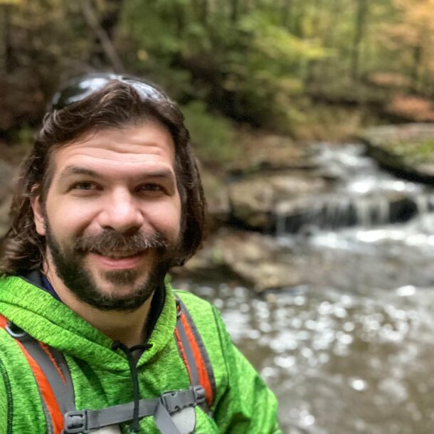
Shawn Gossman
Founder, Hiking with Shawn
Howdy folks! My name is Shawn Gossman and I founded Hiking with Shawn. I’m an avid hiker, cyclist and outdoorsman here in the Shawnee National Forest. I was born and raised in Southern Illinois and never want to leave. Click here to learn more about Shawn Gossman