Hiking with Shawn’s
Guide to the Wilderness Areas
of the
Shawnee National Forest:
Clear Springs Wilderness
Clear Springs Wilderness is a 4,730-acre designated wilderness area within the Shawnee National Forest located in rural southwestern Jackson and northwestern Union counties in Illinois. Clear Springs Wilderness is the most wester wilderness area in the Shawnee National Forest. The closest communities to Clear Springs Wilderness are Wolf Lake to the south and Grand Tower to the north. Clear Springs Wilderness is close to the Big Muddy River as well as the Mississippi River.
Clears Springs Wilderness is a second-growth forested wilderness. The land used for the Shawnee National Forest started being acquired in the 1930s when most of it was failing agriculture and poorer communities. Clear Springs Wilderness Border Bald Knob Wilderness where Hutchins Creek separates the two wilderness areas from one and another. Clear Springs Wilderness is best known for the River to River Trail which runs right through it.
HOW TO GET TO THIS WILDERNESS AREA
Check out this map to see the area of Clear Springs Wilderness.
To reach Clears Springs Wilderness, from Route 3 around Murphysboro-drive south until you cross the Big Muddy River south of Grand Tower. Take your immediate left after crossing the Big Muddy River onto Muddy Levee Road which levees Big Muddy from agriculture on the other side. Drive to the T and turn left and then take your next right onto Pine Hills Road. Drive up the road until you get to the first trailhead on your left which is Godwin-West and the start of Clear Spring Wilderness Area.
TRAILS WITHIN THIS WILDERNESS AREA
King Hollow Trail is a 5.2 out and back trail which is considered moderator difficult at about 479’ of elevation. This trail starts at Godwin-West trailhead on Pine Hills Road and goes to Hutchins Creek. It is said to be poorly marked so hiking it would likely be best when the leaves are gone.
McCann Springs Trail is the long way to Inspiration Point (out and back, short hike). This hike is a little bit more hilly and rugged but provides more distance to Inspiration Point for those looking for more mileage. To get to the trail head, take Muddy Levee Road from Route 3 and turn left at the T and then take your next right on Pine Hills Road. The trailhead is the first trailhead on your right.
Inspiration Point Trail is about an eighth of a mile out and back with about 165’ elevation. The trail takes you to one of the tallest scenic overlooks in the Shawnee National Forest. From this overlook, you can see LaRue Pine Hills to your left, Muddy Levee Road in the center, Big Muddy River to your right and the Mississippi Valley straight ahead in the distance. Getting down to the overlook from the trail can be steep for some – please use caution. To get to this trail, follow Pine Hills Road, passing McCann Springs Trail on your right and continuing up the road until you get to the next trailhead on your right. That is for Inspiration Point.
White Pine Trail from Pine Hills Road to Pine Hills Campground.
Godwin-West is the trailhead for River to River Trail that enters Clear Springs Wilderness. This rugged and hilly out and back trail will take you to Hutchins creek (5-6 miles one way). To get to it, pass McCann Springs and Inspiration Point Trailheads. The next trail on your left will be Godwin-West. Equestrian users also use this trail – please yield to horseback riders and talk to them in a friendly manner so that the horse knows you’re human.
WHAT THIS WILDERNESS HAS TO OFFER
Clear Springs Wilderness Area’s main feature is the River to River Trail which runs from Godwin-West Trailhead to Hutchins Creek where the creek separates Clear Springs Wilderness and Bald Knob Wilderness. Hutchins Creek provides water sources (filtering required for drinking) and wading/swimming holes when the water is down. While there are some bluffs in Clear Springs Wilderness, there isn’t many bluff features along the way. The area is a very good choice for wildlife viewing, birding and wildflower viewing. Staying on designated trails is highly suggested as most of the trails consist of steep ridgelines whereas off trail will be extremely rugged and steep.
SPECIAL CONSIDERATIONS FOR THIS WILDERNESS AREA
Clear Springs Wilderness follows the same guides listed on our Main Wilderness Guide article.
There are no restrooms or trash services at trailhead for this wilderness. Please practice Leave No Trace ethics and pack out what you pack in.
Venomous snakes occur within this and nearby areas including the copperhead snake, cottonmouth snake and the timber rattlesnake. Avoid a negative experience with a venomous snake by watching where you step, staying on the trail, giving snakes plenty of room and never attempting to handle or harm a snake.
This area consists of rugged and steep terrain, rolling hills and sometimes very muddy conditions. Accessing this area can be a challenge and is often considered a difficult level of recreation. Please plan accordingly before venturing into this area.
Cell phone signal may not be available in many areas of Clear Springs Wilderness.
EMERGENCY INFORMATION FOR THIS WILDERNESS AREA
The nearest hospital from Clear Springs Wilderness is located in the City of Anna, Union County Hospital which is about 22-miles from the Godwin-West Trailhead.
For emergencies – dial 911 and follow the instructions of the 911 operator.
WHAT’S CLOSE TO THIS WILDERNESS AREA?
The closest community to this wilderness area is Wolf Lake. There are no businesses or supply capabilities in Wolf Lake, but the City of Anna-Jonesboro nearby does have adequate shopping, gas and other retail centers.
Other points of interest worth checking out near this wilderness area include Bald Knob Wilderness and Hutchins Creek which separates Clear Springs Wilderness from Bald Knob Wilderness. LaRue Pine Hills Snake Road is also nearby to Clear Springs Wilderness.
Pine Hills Road and Pine Hills Campground are also very close to this wilderness area. Other nearby lodging is Rustic Hideaway Cabins in Jonesboro.
VIDEOS OF THIS WILDERNESS AREA
Check out the following video footage of this particular wilderness area.
PHOTOS OF THIS WILDERNESS AREA
Check out the following photos of this particular wilderness area.
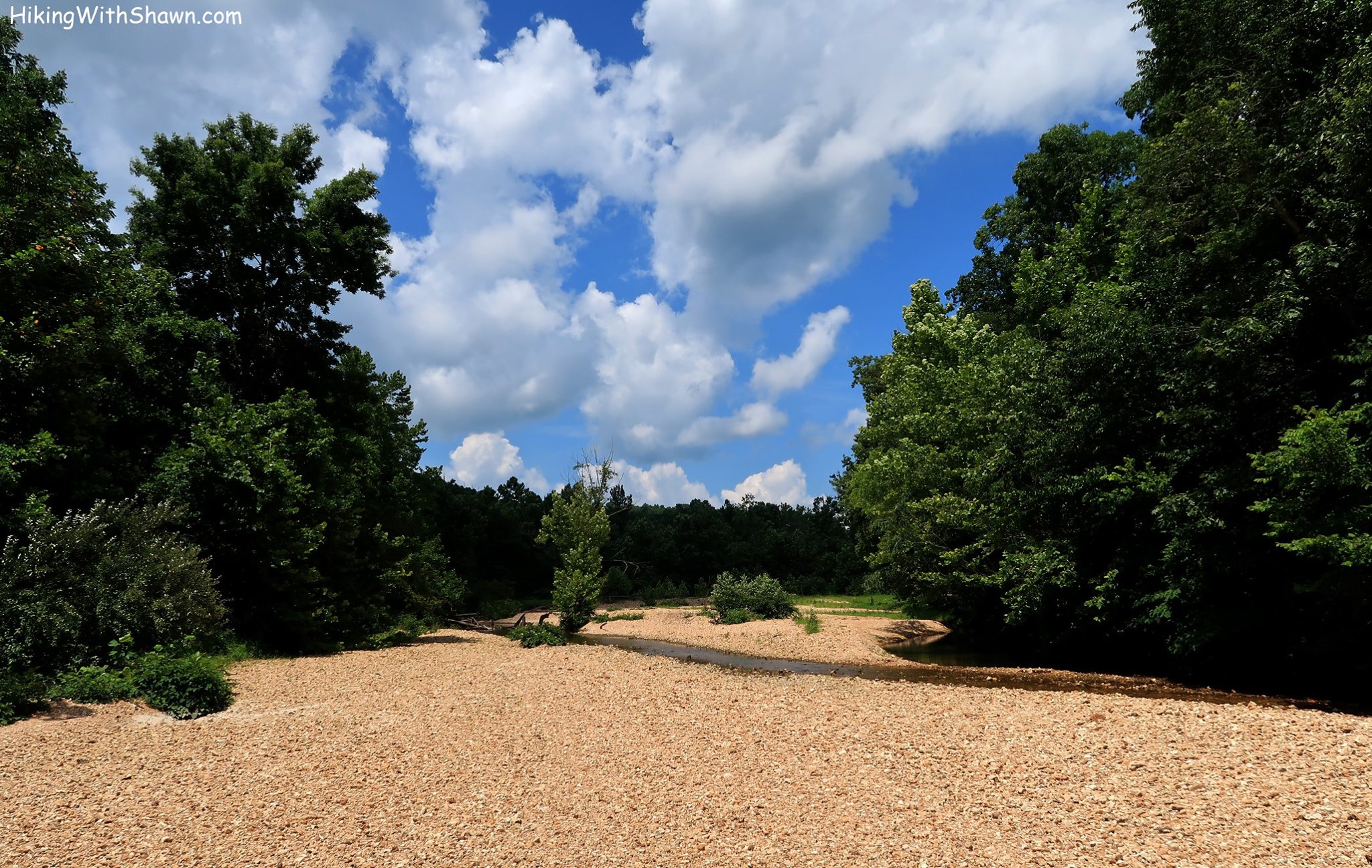
Hutchins Creek

Pine Hills Campground

Godwin West

White Pine Trail
Thank you for taking the time to read this Wilderness Area Guide. This and the other 6 guides took a while to create and are offered for free of charge. Please consider supporting my efforts of making these guides by sharing them with others, especially on social media. You can also support my efforts by following me on YouTube, Facebook, Instagram, Twitter and the Official Website for Hiking with Shawn. Consider becoming a Patreon Member or purchasing some official merch from the Hiking with Shawn Online Shop. Thanks again for checking out this guide and until next time, I’ll see you on the trail!
Shawn J. Gossman
Host
Shawn is the founder and host of the YouTube Channel, Hiking with Shawn as well as Hiking with Shawn LLC. Shawn hikes, backpacks and visits various forested areas in the Shawnee National Forest, local state parks and other areas promoting outdoor recreational activities to obtain video to show to locals and non-locals alike. Please support Shawn’s efforts by sharing this post and leaving a comment below.