Giant City Red Cedar Trail Guide
Giant City Red Cedar Trail is the longest hiking trail within Giant City State Park. It is commonly used by hikers, backpackers, trail runners, birders, and nature watchers.
Getting to Giant City Red Cedar Trail is easy. The trail is monitored and maintained by park staff to ensure that all visitors can enjoy using it.
In this guide, you’ll learn everything you need to know to start enjoying Giant City Red Cedar Trail today.
Directions to Giant City Red Cedar Trail
Getting to Giant City Red Cedar Trail is easy but can be confusing if you’re unfamiliar with the area.
Take Giant City Road from Highway 13 in Carbondale for 10 miles. Turn left and go into the Giant City Campground. If you pass the Giant City Stables, you’ve gone too far.
Once you’re in the campground, slowly drive through the campground and to the tent camping area. The Giant City Red Cedar Trail trailhead is located at the end of the parking lot. This is where you start and finish.
- If you plan to camp (see below), you’ll need a permit from the Campground Kiosk at the entrance or get one from the Visitor Center in the state park.
- All roads leading to the trailhead are paved and can be driven by all vehicles. The parking lot for the trailhead is gravel.
WINTER TRAVEL: Giant City State Park is hilly, and conditions could be hazardous if wintry precipitation has fallen. Please use caution when visiting the park after winter events. At times, the roads throughout the park will be a priority for snow removal. It is important to have a plan B, just in case.
PUBLIC HEALTH: Please see the Illinois Department of Natural Resources (IDNR) website for any public health or safety closures within Giant City State Park. Try to have a Plan B just in case access is restricted within the park.
Trail Information for Giant City Red Cedar Trail
Giant City Red Cedar Trail is marked as a 12-mile loop. Some claim it’s around 11 miles, while others say 13. I’ve tracked it to around 13 miles myself.
The trail is moderate in difficulty. There is about 1,200′ of elevation gain. It is best to go counterclockwise unless you want more hills, then you should go clockwise.
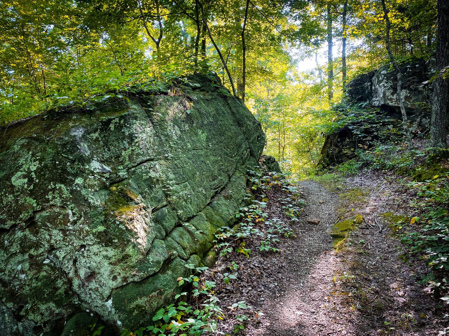
The trail is blazed with white diamonds with red circles in the middle. Some trees have red circles spray painted on them, too. The trail is typically cleared throughout the year and is easy to follow. However, some areas of the trail could be overgrown during the summer.
The trail is a true loop that starts and finishes at the same place.
About halfway into the trail, there is a primitive campground. There are two vault toilets, picnic tables, fire pits, and trash cans. There is no electricity or water. There is easy access to Shiloh Road from this campground. You must get a camping permit from the Main Campground (where you parked) or the Visitor Center. It costs about $8.00.
Giant City Red Cedar Trail is closed to hiking/camping during firearms hunting seasons. Please see the IDNR Hunting Website for more information about hunting season.
Pets are fine as long as they are on a leash.
TRAIL HAZARDS: You should be aware of some hazards associated with this trail.
- Dangerous areas along this trail include high cliffs, rocky terrain, creeks, road crossings, and steep areas. Please use caution when using this trail.
- Venomous copperhead snakes occur along this trail.
- Poison ivy occurs along this trail. Stay on the trail to avoid contact with most of the poison ivy.
- This trail will be hazardous when wet or during wintry conditions.
- Ticks, mosquitoes, and biting flies occur along this trail.
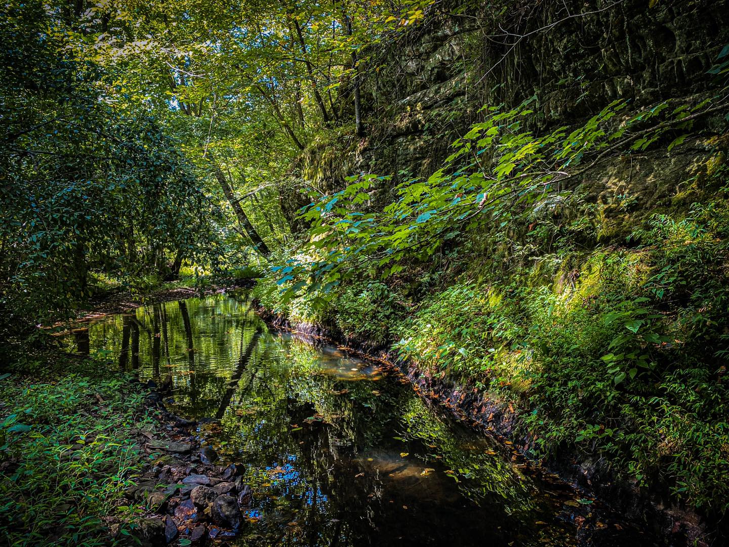
- During wet or wintry conditions, creek crossings may result in you getting wet. Creek crossings are unavoidable along this trail.
- You will cross and use some of the River to River Trail and the equine trail. You may encounter horseback riders. Please yield to equestrians and talk to them so their horses know you’re not a threat.
- Please use caution around road crossings along the trail.
- Giant City Red Cedar Trail is more remote than other trails within the state park. There will be fewer people and fewer forms of assistance.
- Cell phone reception isn’t always available along the trail.
What You Will See along the Red Cedar Trail Hike
There is a lot to see along the Giant City Red Cedar Trail. There is much to see on the trail and some interesting things off the trail. You should try remaining on the designated trail as much as possible for your safety and prevent getting lost or turned around.
Red Cedar Trail is on All Trails. You can get paper maps from the Visitor Center.
If traveling counterclockwise, the start of the trail features a hike through a hardwood forest with some scenic ponds along the way. You’ll hike for a while and reach your first road crossing around the Giant City Stables. You might encounter some horses in the pasture. They are typically very friendly and might walk toward you out of curiosity.
Use caution as you cross Giant City Road. As you continue into the woods, you’ll cross the equestrian trail soon after. Remember to yield to horseback riders if you see them. Talk to the rider and ask about their day. Once you cross Giant City Park Road (use caution), you’ll start getting into the more scenic area of the trail.
The area between Giant City Park Road and Shiloh Road of the Giant City Red Cedar Trail is the best. These areas are full of scenic creeks, bluffs, natural shelters, and interesting gems along and off the trail. If you go after we’ve had a lot of rain, the creeks may be running, and there will be beautiful cascades and small waterfalls along the area. But you might get your feet wet in the process!
After about 6 miles of hiking, you’ll reach the primitive campground. If you’re hiking in the summer months, we recommend putting a hidden cache of water bottles in the trees at the campground, especially if you plan to camp. You can easily access the campground from Shiloh Road.
Remember you need a permit to camp. If you’re hiking or trail running the entire trail, the campground is a great rest stop, or if you need a bathroom break.
Continuing past the campground on the trail, you’ll start to get into areas with old roads, grasslands, and small fishing ponds. A map or trail app comes in handy when you get into the grassy area near Giant City Park Road. Also, if it’s wet in that area, you’ll enjoy the Red Cedar Falls. The trail to the waterfall is not maintained or designated. Please use caution around the waterfall.
As you close on the trail’s end, you’ll start using some of the River to River Trail.
While we enjoy a two-day backpacking trip in the summer months, the Giant City Red Cedar Trail is best used during early spring when wildflowers are blooming and winter when leaves are off the trees, and you can see everything.
A half marathon trail run event is also held on this trail if you’re interested in participating.
History of the Giant City Red Cedar Trail
The natural history of Giant City Red Cedar Trail and the state park is very interesting. Over a hundred thousand years ago, an ice sheet covered most of Illinois. This area of the region was at the end of a glacier. The rock formations and bluffs we see today were created through ancient oceans, earthquakes, and erosion. The bluffs are the most ancient things out there. They’re much older than dinosaurs.
Native Americans used this part of the region in early archaic times. The Late Woodland and Mississippian cultures were known throughout southern Illinois. They built stone wall-like structures called Stoneforts. They carved and painted rock art that depicted their language and religion. They created tools and weapons using chert from the ancient bluffs. Quite a bit of southern Illinois also features the very horrific Trail of Tears route.
When European settlers arrived, they migrated to southern Illinois from southern states because the land reminded them of the south. They attempted to turn the region into farmlands by extracting all timber resources. This caused massive erosion, and most farming operations failed, leaving the settlers very poor. During the Depression, the was purchased by the state and federal government and turned into a state park. The Civilian Conservation Corps (CCC) helped to create most features throughout the park, including many trails and the Giant City Lodge.
Today the Giant City Red Cedar Trail is used all year long primarily by hikers, backpackers, and trail runners. Other parts of the park offer more hiking, equine, road cycling, picnicking, camping, and dining activities. Giant City State Park is also known for having many events and free programs throughout the year on the weekends. It’s one of the best state parks in southern Illinois.
Other Stuff To Do Around the Red Cedar Trail
There are many recreational opportunities around the Giant City Red Cedar Trail. There are other hiking trails located within the park. You can enjoy mountain biking at the nearby Touch of Nature Trails. Enjoy kayaking at Little Grassy and Devil’s Kitchen Lakes. The Shawnee National Forest is also close to this area.
There are many lodging options available around Giant City State Park. There are electric and non-electric campground options. There are cabins available for rent. There are hip camps and Airbnb rentals around the area. There is an equine campground. Makanda Inn is also a great option right by the state park. Hotels are available in nearby Carbondale.
Giant City Lodge offers breakfast, lunch, and dinner options. It’s best known for its fried chicken dinner on the weekend. There are other great dining options in nearby Carbondale. This area is around the Shawnee Hills Wine Trail. Many wineries, vineyards, breweries, orchards offer dining options, drinks, entertainment, and more.
Visit the Giant City Visitor Center for park merchandise and souvenirs. Head into Makanda and visit the Boardwalk for unique locally made gifts, snacks, and a unique experience. Makanda is known for being a Hippy Town. Carbondale has many shopping opportunities. There are many different shops around Union County near the Giant City Red Cedar Trail.

Giant City Red Cedar Trail
Red Cedar Bluffage

Red Cedar Campground
Red Cedar Creek
Please Support Hiking with Shawn
Alrighty folks, I hope you have enjoyed this content. I provide it for free and it takes a while to create. If you would be so kind enough to support my efforts, you can do so by sharing this post with others, especially on social media. Be sure to subscribe to my YouTube Channel to see my latest videos, shorts and live streams. Follow me on Facebook, Instagram, Twitter and TikTok for unique content that you will only find on those pages. You might also join my Southern Illinois Hiking & Outdoor Resources Group on Facebook, too!
You can also support me by becoming a Patreon Supporter for as little as $3/month and you can cancel anytime (no contracts or catches). Patreons get access to extra features, exclusive articles, sticker packs, gifts and more. Consider buying official Hiking with Shawn Merchandise as another way to support me. I spend a lot of money on Hiking with Shawn and because of extremely high public land permit fees, I make very little money in return so everything helps.
Thanks again for checking out another one of my articles and until next time, I’ll see you on the trail!

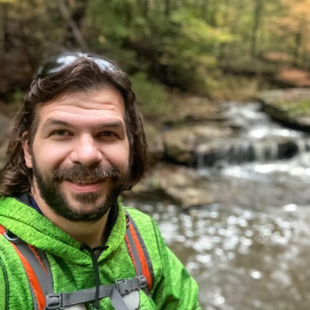
Shawn Gossman
Founder, Hiking with Shawn
Howdy folks! My name is Shawn Gossman and I founded Hiking with Shawn. I’m an avid hiker, cyclist and outdoorsman here in the Shawnee National Forest. I was born and raised in Southern Illinois and never want to leave. Click here to learn more about Shawn Gossman
Trackbacks/Pingbacks