Mill Branch Trail Guide
Mill Branch Trail is one of the most unique hiking trails in the Shawnee National Forest.
(Moderate – 1.8 miles – Loop)
There’s no other trail quite like Mill Branch.
This trail can be accessed at Bell Smith Springs in the Shawnee National Forest of southern Illinois.
The particular trail is full of history, from an early pioneering past to a natural history that occurred millions of years before humans existed. This trail has some of the most ancient rock formations of the entire Shawnee National Forest.
If you’ve never been to Mill Branch Trail, you’re truly missing out because it is the equivalent of the Garden of the Gods but in the central part of the Shawnee National Forest.
Enjoy this free guide on hiking in this area, and if you’d like to, feel free to leave me a tip for creating and providing this guide to you at no cost.
Jump to Section:
- Directions to the Trail
- Trail Information
- Nearby Lodging and Dining
- Trail Photo Gallery
- Trail Video Gallery
Directions to Mill Branch Trail
Getting to the Mill Branch Trail is easy. Below are Google Map directions from various locations, which are the easiest and fastest way to the trail.
From Carbondale, IL, to the Trail (51 miles)
From St. Louis, MO, to the Trail (157 miles)
From Chicago, IL, to the Trail (334 miles)
From Nashville, TN, to the Trail (180 miles)
From Evansville, IN, to the Trail (82 miles)
CAUTION: Gravel Roads
Some of the roads to the Mill Branch Trail are gravel (including Ozark and Bell Smith Springs Roads). These roads have potholes, some being very large. After heavy rain, severe erosion is possible. Maintenance on these roads is infrequent due to budgeting issues and heavy tourist traffic use during the nicer months. Please be cautious when traveling on these gravel roads, and remember that people live on them. Drive slow, share the road, and yield at the potholes. Most any vehicle should be able to make it.
Hazardous Road Conditions
During the winter, the roads to this trail may be hazardous, especially on gravel roads. These roads will likely remain untreated and unplowed if snow or ice is present. In most cases, you’ll need a four-wheel drive vehicle to use these roads. If you get stuck and stranded, cell phone reception may not be available where your vehicle is disabled.
Gas Up and Gear Up
There are no gas stations or stores around this trail. Ensure you have plenty of gas in your vehicle before driving to this trail. Gas stations are available within the city limits of Vienna, Goreville, Harrisburg, Golconda, and Metropolis. Make sure you gear up with plenty of water and snacks before you drive to this trail, as there are no stores present or reliable water sources.
Trail Information and Points of Interest
The Mill Branch Trail is a moderately difficult, lightly trafficked loop trail that is around 1.8 miles in length. The max elevation gain is under 150 feet.
The trail is designated for hiking only. Hunting, motorized vehicles, cycling, and equestrian use are prohibited from this recreational area. This trail, trailhead, and the nearby picnic area are for day use only. Camping and overnight parking are prohibited.
Plenty of parking is at the main trailhead, with additional parking spots along the picnic drive next to the trailhead. Picnic tables and grills are available in the picnic area. There are no restrooms available or water sources.
Cross the creek to the right of the main trailhead sign to access the Mill Branch Trail loop. A cluster of rocks has laid down in a ford where people cross. The deeper water to your right is a favorite summertime swimming hole for many locals and tourists alike.
Walk about 50 feet past where you crossed the ford, and you’ll read the start of the loop. The blazes are red diamonds and red arrows.
NOTE: During flooding conditions, the creek may be impassable.
The loop is best taken counterclockwise.
If traveling counterclockwise, the following points of interest will be observed in order:
- You will notice Hunting Branch (creek) to the left of the trail.
- Along the first portions of this trail, take note of overlooks and natural shelters along the creek. Use caution as there are some high portions of the bluff.
- At coordinates 37.52296, -88.66659, this is the site of an old grist mill. These mills were popular during early settlement while timber resource extraction took place. There are no major visible signs of the mill anymore, but you might be able to tell where it was by looking at your surroundings.
- Shortly past the mill site is one of the most unique spots in the Shawnee National Forest. It is a rock barren with a stone creek carved in the middle of it. This ancient formation occurred millions of years before humans ever existed. During wet conditions, the creek has numerous waterfalls and cascades. WARNING: During wet and wintry conditions, this portion of the trail will become very slick and extremely hazardous. Please use caution.
- Continue down the trail to where you cross an easier section of the creek that is no longer barren.
- Enjoy a walk through the National Forest, occasionally seeing smaller waterfalls, hardwood forests, and even prickly pear cactus (native to Illinois) once you return to the barren area.
- After you pass the barren area, you’ll continue hiking until you reach an area with tall bluffs and large natural shelters to your right.
- This area also has a rock beach-type area where many people enjoy swimming during hotter weather. Please be safe about swimming; no rescue personnel are at this site.
- You will then turn at the bluffs continuing on the red trail and shortly get back to the start of the loop, where you can then return to where you parked your vehicle.
While the Mill Branch Trail is less than two miles, there is much to see along this trail. If you don’t make time to visit this area, you’re truly missing out on something very special.
The red trail is well-marked, well-used, and easy to follow all year long.
Please use caution as people have been seriously injured to even died in the area. Many injuries and deaths occur from falling from the tops of cliffs, accidental drowning, and heat/cold-related illnesses. Please note that mosquitoes, ticks, and poison ivy occurs in this area. Venomous copperhead snakes are present in this area. If you use common sense and put safety first, you’ll enjoy a hazard-free hike for the most part.
Other hiking opportunities in this specific area include Bell Smith Springs, Burden Falls, Jackson Falls, and Camp Ondessonk.
Nearby Lodging, Dining, and Shopping
For nearby lodging in the area, check out the Potel Airbnb located in Ozark. You can also rent a cabin (during the non-camping season) at Camp Ondessonk. Tent camping is available at Red Bud Campground for a small fee (water and restrooms are available-no electricity). For equestrian camping, check out Hayes Creek Campground in Eddyville.
For dining, there are a few options close by. For luck and dinner, check out Murphy’s Pitt BBQ in Ozark. For breakfast, lunch, dinner, and drinks (and entertainment), check out Shotgun Eddy’s in Eddyville. There are horse high-lines available at Shotgun Eddy’s.
For shopping, check out the nearby communities of Vienna, Goreville, and Harrisburg. Gas stations, more lodging and dining options, grocery stores, and unique gift shops are available in these communities.
Thank you for checking out my free guide for the Mill Branch Trail at Bell Smith Springs in the Shawnee National Forest. Please help me write this free guide by sharing it with others, especially on social media. You can also support me by becoming a Patreon Subscriber (more features) for as little as $3 a month. There are no contracts, and you can cancel anytime. Please subscribe to my free newsletter for more hiking tips and guides.
Watch the videos for this trail!
Below is a recent video that we filmed while enjoying this area.
Check out the trail gallery!
Enjoy these photos taken around this area!
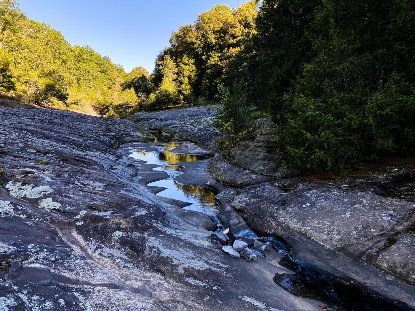
Mill Branch Trail Cascade
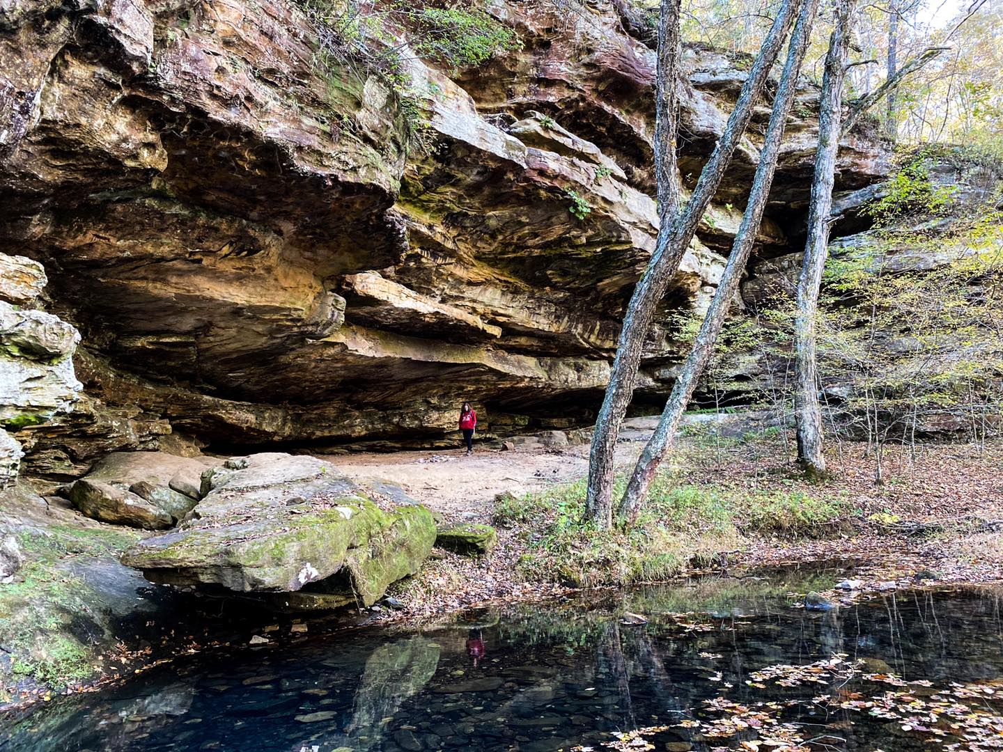
Mill Branch Shelter
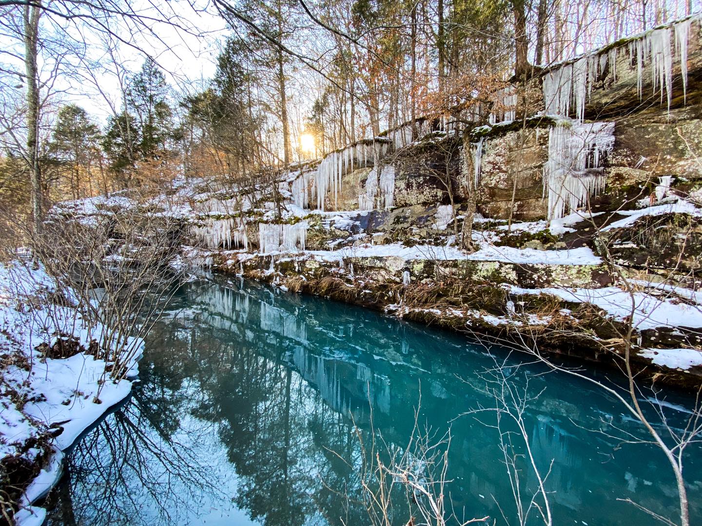
Hunting Branch Winter
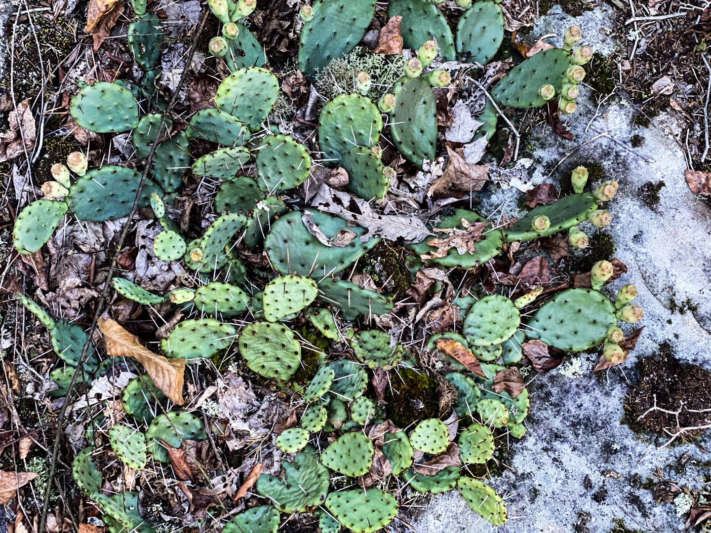
Prickly Pear Cactus
Please Support Hiking with Shawn
Alrighty folks, I hope you have enjoyed this content. I provide it for free and it takes a while to create. If you would be so kind enough to support my efforts, you can do so by sharing this post with others, especially on social media. Be sure to subscribe to my YouTube Channel to see my latest videos, shorts and live streams. Follow me on Facebook, Instagram, Twitter and TikTok for unique content that you will only find on those pages. You might also join my Southern Illinois Hiking & Outdoor Resources Group on Facebook, too!
You can also support me by becoming a Patreon Supporter for as little as $3/month and you can cancel anytime (no contracts or catches). Patreons get access to extra features, exclusive articles, sticker packs, gifts and more. Consider buying official Hiking with Shawn Merchandise as another way to support me. I spend a lot of money on Hiking with Shawn and because of extremely high public land permit fees, I make very little money in return so everything helps.
Thanks again for checking out another one of my articles and until next time, I’ll see you on the trail!

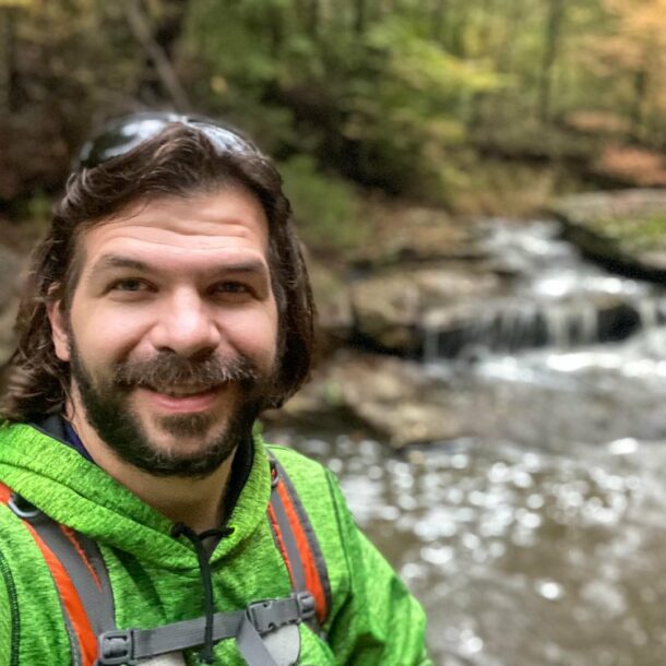
Shawn Gossman
Founder, Hiking with Shawn
Howdy folks! My name is Shawn Gossman and I founded Hiking with Shawn. I’m an avid hiker, cyclist and outdoorsman here in the Shawnee National Forest. I was born and raised in Southern Illinois and never want to leave. Click here to learn more about Shawn Gossman