27
Safe Hiking Trails
in Southern Illinois
during Hunting Season
Shotgun hunting season starts this weekend, and you might wonder if there are safe hiking trails!
Just because it’s hunting season doesn’t mean you have to give up a weekend of hiking. Hiking is the main exercise for many of us; giving up fitness routines can be consequential. But it is also essential to be safe and to share the forest with other users who get it way less than everyone else. There are plenty of safe hiking trails in the Shawnee National Forest and Southern Illinois.
I don’t stop during firearms hunting season. There are plenty of places to go and safely hike and even bike. But I do stay out of areas where hunting takes place. It’s respectful to hunters, and it’s responsible for your safety. If you go out there – please wear blaze orange and be careful.
Instead of risking your safety, why not choose one of these 20+ hiking trails safe from firearms hunting season?
Safe Hiking Trails: Carbondale Green Earth

The Carbondale Green Earth organization has created several natural preserves within the city for you to enjoy around the year.
These are nature preserves. There are no hunting activities allowed within them. Most of these preserves are within city limits, where private hunting grounds are nowhere to be found. These are some of the safer types of trails to explore during firearms hunting season. Some of these Nature Preserves could have private wooded property around there where hunting activities take place. Please use caution around the areas. It would still be a good idea to wear orange.
We’ve yet to explore them. Our plan this year is to go check them out and make some videos for them. I applaud Carbondale Green Earth for creating these.
Let’s check out some of their safe hiking trails below.
Brush Hill Nature Preserve
This was the first nature preserve started by Carbondale Green Earth.
It is a 1-mile loop trail. There is elevation change, so it is considered moderately difficult.
There are many different scenes along this trail, including upland forest, lowland forest, and even former mining operations from previous settlers.
For more information and directions to this trail, check out the Brush Hill Nature Preserve page.
Oakland Nature Preserve
This preserve would be ideal for taking your children to.
There are two 1-mile hiking trails. They are considered easy to hike. Two trails are created for children to learn about what they’re seeing. There is also a demonstration prairie along this preserve.
For more information and directions, check out the Oakland Nature Preserve page.
Chautauqua Bottoms Nature Preserve
This preserve is one of the more popular preserves in the city.
There are multiple trails in this preserve and different trailheads to start at. Altogether, there are about 3-miles of trails, including loop and out-and-back trail types. Most trails are rated easy, aside from one where you might have to cross a creek.
For more information and directions, check out the Chautauqua Bottoms Nature Preserve page.
Fernlands Nature Preserve
This is an excellent trail that is quiet and off the beaten path.
NOTE: This preserve is out of town and the private property around it may have firearm hunting activities. Please use caution if you visit this preserve.
This trail is a 1-mile lollipop loop trail. It is considered moderately difficult to hike. You’ll see ferns growing along the trail due to its moist environment. There are also beautiful clear streams within this preserve.
For more information and directions to this trail, check out the Fernlands Nature Preserve page.
Flagland Demonstration Prairie
This is a sightseeing demonstration of a grass prairie.
There are no trails within this area. The purpose of this preserve is to show you a demonstration of what a grass prairie land would look like. You could get out and take some pictures and look around but remember to Leave No Trace.
For more information about this prairie, check out the Flagland Demonstration Prairie page.
Pyles Fork Nature Preserve
This is a wetland trail, so tall boots may be required during times of rain.
NOTE: There is private wooded land on the NW and SW portion of this property. There could be hunting activities within those private land boundaries. Please use caution if you visit this preserve.
There is a 1-mile loop trail in the preserve. The difficulty of this trail is easy to moderate and depends on how much rain the area has. Trail users will see a precious watershed and wetland forest along this preserve.
For more information and directions to this trail, check out the Pyles Fork Nature Preserve page.
Safe Hiking Trails: Ferne Clyffe State Park

The inner trails within Ferne Clyffe State Park make for safe hiking trails during shotgun season.
The trails not mentioned in this article overlap areas where hunting is allowed. That includes Happy Hollow and the River to River Trail section that goes through the park. You should avoid those trails as hunters will likely be present. But many trails within the park will be safe to use by hikers.
Check out my free state park guide for Ferne Clyffe to get directions and information about each trail. We love going to Ferne Clyffe every hunting season because there is so much to see, especially after a good rain.
Let’s look at some of the safe hiking trails at Ferne Clyffe State Park.
Round Bluff Nature Preserve
This is a great trail if you want to see stuff while getting exercise.
Round Bluff is a Nature Preserve, so you must stay on the designated trail. But don’t worry, there is plenty of incredible sights to see. This is a 1-mile loop with some higher elevation and stair climbing requirements. It is a workout for many people.
There are plenty of bluffs, a champion tree, and beautiful nature scenes to enjoy.
Ferne Clyffe Lake Trail
The Ferne Clyffe Lake Trail is an excellent trail from which to see the lake and even fish.
This is a 1-mile loop trail. The difficulty is rated as easy. The park has recently done work to the trail, making it easier to access when it’s wet.
There is plenty of things to see along the way, including the lake, different trees, and the forest around you. If you have a valid Illinois fishing license, you can fish from the bank of the lake.
Blackjack Oak Trail
This is my favorite trail at Ferne Clyffe State Park.
This is a 1-mile out-and-back trail, but you could make it longer by adding the trails at the end, which are listed below. This is a moderately difficult trail.
You can see all sorts of bluffs, natural shelters, beautiful forests, and amazing scenic overlooks of the lake and the Shawnee National Forest country. As I said, this is my favorite trail at Ferne Clyffe State Park. You get a little bit of everything on this trail.
Big Rocky Hollow Trail
This trail will take you into an enormous canyon of bluffage leading to a tall waterfall.
This trail is less than a mile out and back. It is easy to moderately difficult, pending on how wet it is. The park has done some work to make it easier to cross where the water goes over the trail.
There are user trails in this area – please do not use them. Climbing to the top of the waterfall is not allowed, and people have died as a result of falls. Please avoid making unsafe acts on these safe hiking trails.
Along this short hike, there is a lot to see, including a 100-foot waterfall. There are other smaller waterfalls, bluffs, and scenic creeks.
Rebman Trail
This trail is a designated rock climbing trail.
The trail is a loop trail about a quarter of a mile in length. The trail is moderately difficult due to a creek crossing.
An interpretive sign on a rock tells you about Emma Rebman, who preserved the area before it was public land. There is a designated rock climbing area. When the site is wet, there are active waterfalls. There is much bluffage to enjoy.
Boy Scout Trail
This is another great trail to hike if you’re looking for fitness.
This trail is a half mile in length and out and back. The trail is steep and is a climb up to Goreville.
During wet conditions, a fantastic waterfall crosses the trail (use caution). This trail used to be the way into the park. When they closed it, residents of the town protested against it. There are some exciting stories online about it. It is a great trail if you want to add elevation to your hike for fitness.
Hawk’s Cave Trail
Check out this trail to see one of the largest natural shelters in Illinois.
Hawk’s Cave is a loop about a half mile in length. The trail might be moderately difficult due to elevation change and some rocky terrain near the cave shelter.
The cave shelter is one of the largest cave shelters in Illinois. During wet conditions, there are a few lovely waterfalls to enjoy. There is a beautiful creek that you walk over on wooden bridges.
Safe Hiking Trails: Giant City State Park

Giant City State Park is a great place to go for hiking and biking during shotgun season.
Some trails are closed to hikers during hunting. These trails include the horse, Red Cedar, Indian Creek, and the River to River Trail section that goes through the park. Those areas will have hunters present. Check out my free state park guide for Giant City to see more information and directions to these trails.
For biking, many roads within Giant City State Park are paved. They make for some of the best road biking routes in the area. There is a mix of elevation change and some steep hills. If you want a real hill challenge, ride up the hill on South Church Road beside the Makanda Boardwalk.
Let’s look at the best safe hiking trails in Giant City to enjoy this hunting season!
Arrow Wood Interpretive Trail
This is a great trail to bring kids to so they can learn about nature.
The Arrow Wood Trail is next to the Visitor Center. The trail is short and a loop. It is an easy hike.
There are signs along the trail explaining what each tree and area is. It is an excellent trail for education. After you hike it, head into the Visitor Center and buy some Giant City merchandise to help fund park projects.
Post Oak Trail (ADA Compliant)
This trail has recently been a compliant trail for the American Disability Act.
The trail is a third of a mile out and back. The trail is easy for most users. There is a paved path making wheelchair access easy.
There is forest bathing interpretational signage along the trail. There are overlook decks. There is access to the top of Devil’s Standtable. Please refrain from jumping onto the balancing rock. If you fall, you’ll most likely die.
Stone Fort Trail
This trail will lead you to an ancient Native American Stone Fort structure.
This is a lollipop loop trail. The trail length is about a third of a mile. This trail is moderately difficult due to rocky terrain and elevation changes.
When the area is wet, you’ll hike next to a very waterfall cascade. Please use caution around it. At the top is a Stone Fort, once used by Native Americans. There is a sign explaining it. The Civilian Conservation Corps reconstructed the fort. There is also a stunning overlook.
Nature Trail
The Giant City Nature Trail is one of the most popular trails in the park.
This trail is a 1-mile loop. Its difficulty ranges from easy to moderate, with some rocky surfaces and elevation changes present. Do not squeeze through “Fat Man Squeeze,” as that crack often hosts a hibernaculum of venomous copperhead snakes. The snakes are protected by law.
There is a lot to see on this trail. There are plenty of bluffs and natural shelters. When wet, small waterfalls could be present. The “Streets” provide a street-like cut through the bluffs. There is a balancing rock and an area with many carvings from previous settlers.
Devil’s Standtable Trail
This is a great trail if you’re looking for something a bit wilder in nature.
This is a third of a mile out and back trail but can be turned into a longer loop trail by adding the Post Oak trail. If you do add that, it will be very rugged at times. Please exercise caution.
On this hike, there is a lot to see, including the mushroom rock or balancing rock called Devil’s Standtable. The term “devil” has been used in many natural formations in the area due to rough translations from Native Americans. There are also lovely waterfalls to see along this trail when it is wet.
Trillium Nature Preserve
Trillium Nature Preserve is one of the best safe hiking trails the park has to offer.
Trillium Trail is a Native Preserve, meaning you must always stay on the designated trail. The trail is a moderately difficult 1-mile loop. It is an excellent trail for exercise, and some people even run it. Please use caution around dangerous areas.
There are bluffs, precious plants and flora, large trees, waterfalls, natural shelters, and scenic overlooks along this trail.
Safe Hiking Trails: Heron Pond

Heron Pond is a great hiking trail to see an area like no other in Southern Illinois.
Heron Pond is a 1.5-mile out-and-back trail. It is a Nature Preserve meaning that it is unlawful to bring a firearm onto the trail for hunting. The trails past the Champion Cherrybark Oak Tree are not within the preserve, and hunting is allowed in that area.
There is a lot to see at Heron Pond. You can see portions of Dutchman Creek and the Cache River where the confluence is. There are different forest varieties, and most have interpretive signage along the way. There is a boardwalk on top of the swamp. There is a champion oak tree that would take several people to hug the tree around completely. It is the trail that got me into hiking!
Safe Hiking Trails: Bell Smith Springs

There are a few safe hiking trails at Bell Smith Springs.
Avoid hiking on the Red Trail. I’ve personally witnessed hunters on this trail. The Blue Trail goes into areas where hunters will be present. But there are some excellent trails to enjoy during shotgun season.
White Trail
This trail will take you to the most famous rock formations in the area.
This trail is a little over a mile in length and contains some loops and out and back. The trail is moderately difficult.
Along this trail, you’ll see many neat things. Devil’s Backbone formation is present. The hand-made CCC stairs are fun to walk back up (insert sarcasm here) and the famous spring that people jump into all summer long.
Yellow Trail
The Yellow Trail will take you to the largest natural arch in Illinois.
This trail is about a mile and a half. It is a lollipop loop. The trail is moderately difficult and requires a creek crossing. The creek could be deep if we’ve had a lot of rain. Please use caution.
The main feature of this trail is the large natural arch it takes you to after crossing the creek. It is the largest natural arch in Illinois. If the area is wet, a waterfall will run through the arch. A ladder in the bluff will take you to the top, or you can take the trail for safer access. The ladder has been there at least since the 30s or 40s.
Safe Hiking Trails: Garden of the Gods

Garden of the Gods provides one of the safer hiking trails in the Shawnee National Forest.
The Garden of the Gods Observation Trail is the only trail where hunting is prohibited. The trail is less than 1-mile in length and is a loop. The trail is easy, and some of it can be accessed by disabled users.
Along this trail, you’ll see many famous rock formations. This includes Camel Rock which is on the back of a US quarter. There are many overlooks along this trail.
Please use caution as people have died from falling on this trail – most recently, a 10-year-old child.
Safe Hiking Trail: Rim Rock

Rim Rock is a great place to hike away from shotgun hunting areas.
This trail is right under 2 miles. It is an out-and-back with a loop on top. The stairs are being replaced, so you’ll have to use the eastern trail to reach the bottom. This trail can be moderately difficult.
This trail has a lot to see, including access to Pounds Hollow Beach. During wet conditions, waterfalls may be present. There is Ox Lot Cave, and a spring is present there. There are bluffs, natural shelters, and a cool street-like area past Ox Lot Cave, up the stairs, and to the left. There is also a Native American Stonefort on this trail.
Safe Hiking Trail: Millstone Bluff

Millstone Bluff is the best trail to visit to get a glimpse of Native American life more than 12,000 years ago.
Millstone Bluff is easy to moderately difficult trail. It is a 1-mile loop. There is a big parking lot and a restroom present. There is some elevation change which can make it moderate. The area is closed to hunting activities. Stay on the trail, as properties around the outer portions of the area may have hunter present. This is an archeological area, and digging/collecting is federally prohibited.
There is a lot to see along this trail. There are signs explaining things along the way. You’ll see a previous millstone quarry operation with a real millstone by the main information sign. There is a Native American Stonefort, cemetery, community, and rock art. This would be an ideal trail for families with children to learn about the ancient history of this area.
Little Grand Canyon

Little Grand Canyon is a great trail to visit to avoid areas where hunting is present.
The Little Grand Canyon trail is a day-use recreation area. Hunting is prohibited. This trail is rugged and very difficult. It is a loop consisting of nearly 3-miles. There are extreme elevation changes, very slick areas, and rolling hills. You walk down a waterfall cascade.
When it is wet or icy/snowy, it is extremely dangerous. Please use extreme caution, whether wet or dry.
There is a lot to see along this trail. When wet (although dangerous), waterfalls are present throughout the trail’s canyon portion. There are interesting rock formations, natural shelters, and very scenic overlooks. You could hike both upper trails and get a good amount of fitness to avoid the canyon when it’s wet. You’ll see the great overlooks on the upper portions, especially along the trail that starts by the restroom.
Tunnel Hill State Trail

Tunnel Hill State Trail is closed to hunting but with an important warning.
All 50+ miles of Tunnel Hill State Trail are closed to any hunting activity. Hunters must remain so far away from the trail. However, a lot of private property butts up against the trail, and hunting will likely be taking place on that property. There is still a risk of firearm-related impacts to the area. Wear bright colors or blaze orange if you choose to use the trail.
I wouldn’t recommend using Tunnel Hill State Trail unless you need it to commute rather than use the roads safely.
This has been a guide for 20+ safe hiking trails in the Shawnee National Forest and Southern Illinois to enjoy during shotgun hunting season. Most of these trails will be entirely safe for use without fear of getting into the crossfire ranger of hunters. I want to emphasize that hunters only get a few weekends a year so let’s show some respect and share the forest by sticking to safer trails while they enjoy their game harvest. Be sure to subscribe to my free monthly newsletter for more exclusive articles, hiking tips, subscriber recipes, and more.
Please Support Hiking with Shawn
Alrighty folks, I hope you have enjoyed this content. I provide it for free and it takes a while to create. If you would be so kind enough to support my efforts, you can do so by sharing this post with others, especially on social media. Be sure to subscribe to my YouTube Channel to see my latest videos, shorts and live streams. Follow me on Facebook, Instagram, and Twitter for unique content that you will only find on those pages. You might also join my Southern Illinois Hiking & Outdoor Resources Group on Facebook, too!
You can also support me by becoming a Patreon Supporter for as little as $3/month and you can cancel anytime (no contracts or catches). Patreons get access to extra features, exclusive articles, sticker packs, gifts and more. Consider buying official Hiking with Shawn Merchandise as another way to support me. I spend a lot of money on Hiking with Shawn and because of extremely high public land permit fees, I make very little money in return so everything helps.
Thanks again for checking out another one of my articles and until next time, I’ll see you on the trail!
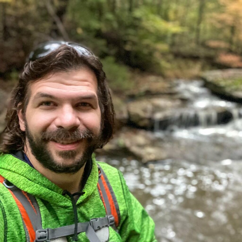
Shawn Gossman
Founder, Hiking with Shawn
Shawn Gossman, known regionally as Hiking with Shawn, is the founder and senior editor of this blog. Shawn has been hiking the Shawnee National Forest for over 15 years. Shawn is a Southern Illinois native and very active in the local tourism community. Learn more about Shawn here.